
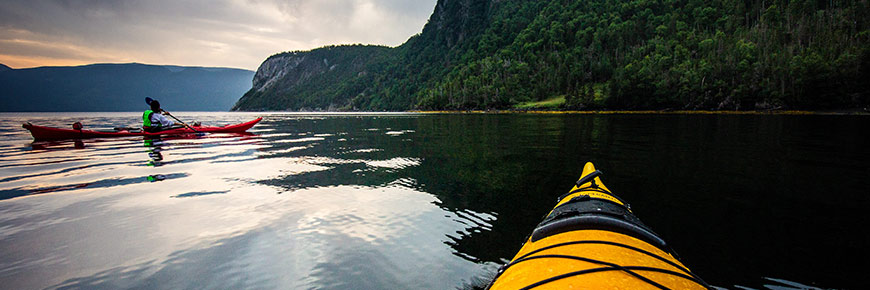
Kayaking
Gros Morne National Park
There are a variety of kayaking opportunities in and around Gros Morne National Park. A paddler’s skill level along with wind, wave conditions, water temperature, and changeable weather are the most important factors to consider in choosing a destination. If unfamiliar with these areas, Parks Canada recommends you seek additional advice from experienced paddlers who are familiar with these locations.
Disclaimer
There are inherent risks with kayaking and other paddling activities. The areas described herein will at times be unsafe due to wind, wave, and weather conditions. Gros Morne National Park has done its best to provide accurate information and to describe the conditions typical of each general area. However, it is up to the users of this information to learn the necessary skills for safe travel by kayak, access additional trip planning materials, and to exercise caution while travelling in the waters in and around any national park.
Users of this information do so entirely at their own risk, and the Parks Canada Agency disclaims any liability for injury, death or damage to anyone undertaking a kayak trip in any of the regions described. This information is no substitute for experience or good judgement.
Weather
- Gros Morne National Park’s weather is highly variable. There are rarely two calm days in a row, even in summer.
- Check the local weather forecast before considering paddling (weather.gc.ca).
- Tidal information is available at tides.gc.ca. (Use location: Gulf of St Lawrence Southeast, Norris Cove)
- Strong winds are common, especially from mid-morning to mid-afternoon. This may contribute to steep breaking waves in shallow waters, especially during opposing tides. Winds may persist for several days during the summer season. Late August can be particularly windy.
- Easterly winds can be violent when blowing down off the mountains along Bonne Bay and through the fjord ponds. The prevailing winds in the summer are from the southwest.
- The water temperature can be cold throughout the summer. Hypothermia is a real risk for paddlers not suitably attired for the water temperatures and weather conditions.
Conditions
Trout River Pond
- This is the most accessible of the fjord lakes within Gros Morne National Park.
- On the north shore there are great views of the barren and an intriguing landscape of the Tablelands. To the south are the contrasting steep cliffs and the forested Gregory Plateau.
- The outer pond has frequent landings on both sides, while the inner pond has frequent landings on the north and far eastern end.
- When there is no wind, the “outer” pond, where you depart from the Day Use Area, can be a good place to paddle.
- Rockfall is common along the south shore of the inner pond.
- Frequent strong winds can trap paddlers in the inner pond.
- Afternoon winds on the pond can be hazardous due to the funneling effect of the fjord walls.
- The water temperature, especially in the inner pond, remains cold throughout the summer. Hypothermia is a real risk for paddlers not suitably attired for the water temperature.
Trout River to Bonne Bay
- A spectacular, volcanic coastline with 350 m cliffs, sea stacks, and caves.
- This section of coastline includes the Green Gardens area with its primitive campsite.
- The coast is exposed to westerly winds.
- The landings are limited and will require careful planning.
- Confused seas occur during strong wind conditions along the shoreline; it is often easier to move out from the cliffs.
Inner Bonne Bay
- The inner bay consists of two arms, the South and East Arms. Both are actually fjords with high cliffs, communities on the water's edge, and many wooded coves that provide landing beaches.
- The South Arm and East Arm are moderately protected from winds and can offer reasonably sheltered paddling for most of the summer, especially in the morning.
- Even when there are strong southwesterly winds outside Bonne Bay, the inner bay may be calm. The hills offer shelter from the prevailing southwesterly summer winds, especially close to shore.
- The surface water temperature is reasonably warm in July and August (15-20°C).
- The mouth of Eastern Arm, especially near Shag Cliff, can be challenging for paddlers. Confused waters occur when strong winds from the west, southwest or east interact with the cliffs and tides to create unpredictable and chaotic wave patterns.
- It is usually windy in the afternoon.
- The current in the Tickle (the narrow entrance into East Arm) is usually not strong enough to be a challenge for paddlers, except possibly during periods of extreme high tides.
Western Brook Pond
- Even on fine summer days, this fjord pond is subject to strong and confused winds generating large swells and breaking waves. There are few landing sites as most of the pond is surrounded by steep cliffs. Kayaking is not recommended.
Shallow Bay
- Located just north of the community of Cow Head, this bay is 2.5 km across, extends from Belldowns Point to Lower Head, and is bordered by the sandy Shallow Bay Beach.
- The bay offers views of the Long Range Mountains and great sunset vistas.
- Both Shallow Bay Campground and the Shallow Bay Day Use Area provide access to the beach.
- There are breeding bird colonies on Belldowns Islands at the south end of the bay. Please respect the birds’ space. Do not land on the islands and during breeding season do not get too close to the island’s shoreline.
- The bay provides partial shelter from the open Gulf of St Lawrence but is exposed to westerly winds.
- The sandy beach provides ideal and almost continuous landing areas in the bay.
Gulf of St Lawrence and Outer Bonne Bay
Gros Morne National Park is adjacent to the Gulf of St Lawrence and the outer part of Bonne Bay. These are exposed marine areas subject to strong westerly winds most days. Landing areas are limited and large sea swells and breaking waves are common. Strong and reliable surf entry and exit skills are a must. Parks Canada recommends you seek additional advice from experienced paddlers who are familiar with these areas before kayaking in these areas.
Camping with Your Kayak
Three of our campgrounds (Trout River, Lomond and Shallow Bay) are suitable areas for launching and landing a kayak.
A number of primitive campsites are also accessible by water. These include the site at Green Gardens and the one at Stanleyville in Bonne Bay, and the remote eastern end of Trout River Pond. A permit must be purchased in advance for all primitive campsites within Gros Morne National Park to ensure that sites are not overbooked or overused. Those interested in backcountry camping must call 709-458-2417 or email pc.grosmorne.pc@canada.ca for information on locations, permits and how to reserve a backcountry campsite.
- Date modified :