
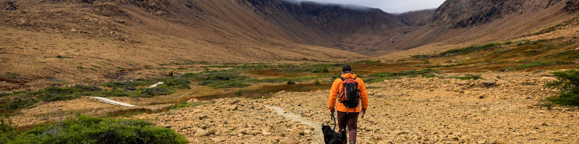
The Tablelands
Gros Morne National Park
Half a billion years in the making – formed deep in the middle layer of the Earth, in the mantle. It was thrust up as ancient continents collided, building the Appalachian Mountain chain and assembling a supercontinent called Pangea!
More that 400 million years of those towering mountains eroding were needed to reveal what we see today: a surreal barren, orange landscape -- the Earth's inner soul: the mantle - exposed to you the way few have seen it.
How do you want to experience the Tablelands?
Hike it with a Guide
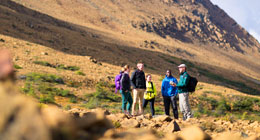
Walk Upon the Earth's Mantle Guided Walk: Find times and details for tours.
Walk upon the Earth’s mantle - normally found far below the earth's crust. This walk reveals some of the earth shaking ideas that changed how we understand our planet. Parks Canada guides will help you explore this bizarre and beautiful landscape, the glacially carved valleys and the unique plants and vegetation that call the Tablelands their home! This two-hour guided hike will prepare you to better understand the world significant geology of Gros Morne as you explore the park.
Hike it on Your Own
The Tablelands Trail is rated easy (4 km return) and follows an old roadbed as it skirts the base of the mountain. You will see unusual plants and rocks as you enjoy broad panoramic views.
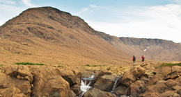
The trail ends in the glacially carved Winter House Brook Canyon. For a shorter walk, branch off onto the Serpentine Loop, where you will see characteristic plants of the Tablelands alongside a winding path.
For experienced and prepared hikers, an off-trail trek up its steep slopes is one of the most unique hiking opportunities in eastern North America. Consult with park staff to select the best and safest route options. There are no route markers to the top of the Tablelands. There are no route markers to the top of the Tablelands, route finding and navigation skills are required. You are responsible for your own safety.
Trout River Pond Trail The path less traveled. Hike along the shore of Trout River Pond and into the heart of the Tablelands. Accessible by two feet and a heartbeat, this trail can best be described as pristine.
Watch it all Unfold
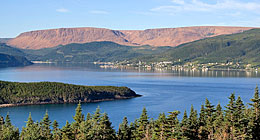
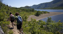
Take in the views - Pull back the lens to see the beauty of the Tablelands in striking contrast to the surrounding green hills and blue saltwater. The Lookout Trail and the communities of Norris Point and Woody Point offer beautiful and different vistas of the Tablelands – check it out!
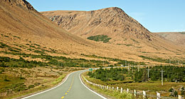
Drive the scenic route 431 - The road between Woody Point and Trout River is truly one of the most spectacular you'll see. What strikes you most is the contrast of colour between the mountains that tower above you. One side is lush green; the other, a brilliant, amber colour - all divided, it would seem, by the yellow line of the highway.
- Date modified :