
Wapusk National Park map with Cree names
Wapusk National Park
Learn more: Cree Names and the Landscape of Wapusk National Park
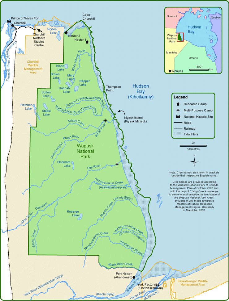 Wapusk National Park Map with Cree names
Note: Cree names are shown in brackets beside their respective English name.
Image description
The northwest section of the park is identified as coastal fen, while the northeast section along the coast down to just north of the Owl River is coastal ridges and fen. The southeast section of the park along the coast is coastal forested fen, while the coast itself in Hudson Bay is an intertidal zone. The southwest portion of the park is boreal transitional forest, while a ribbon of the park bordering that portion to the east is designated as forested peat plateau bog. The remaining area, which makes up the majority of the park’s land, is peat plateau bog.
An inset map shows the entirety of Hudson Bay with southeastern Nunavut, northeastern Manitoba, northern Ontario, and northwestern Quebec all identified.
Cree names are provided according to the Wapusk National Park of Canada Management Plan of October 2007 and with the help of "Using Cree knowledge to perceive and describe the landscape of the Wapusk National Park Area" by Maria M'Lot, thesis towards a Masters of Natural Resource Management Degree, University of Manitoba, 2002.
Base data used to compile this map was supplied by Natural Resources Canada, Manitoba Land Inventory, and Parks Canada Agency.
This map is intended for general orientation purposes only and should not be used for navigation.
Map is projected in the UTM coordinate system.
- Date modified :