
Temporary closures at Parks Canada places on PEI
Prince Edward Island National Park
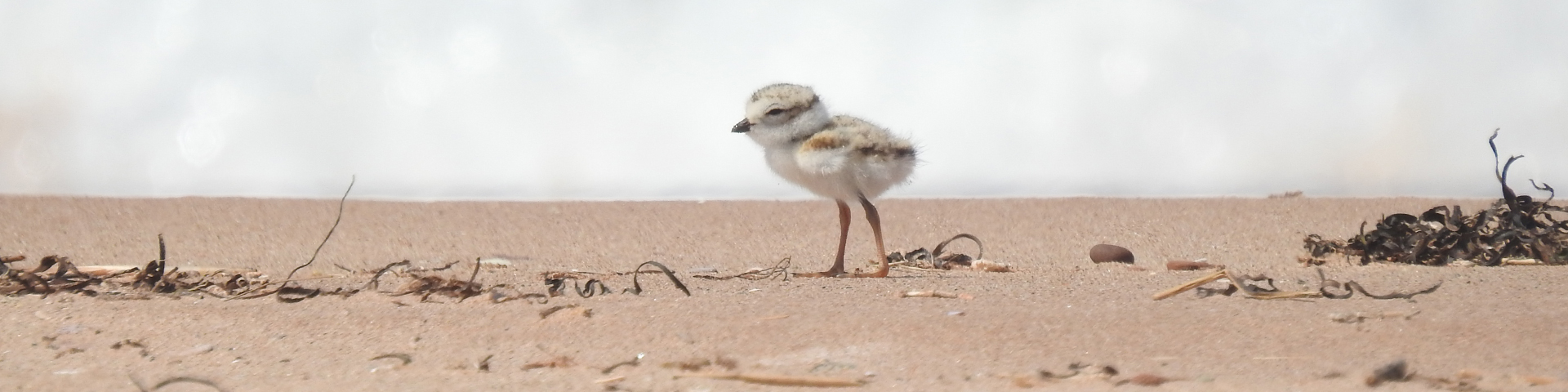
Beach Closures for Piping Plover
When Piping Plover are present and breeding, signs are posted and the areas are closed to all public use and travel pursuant to section 7(1) of the National Park General Regulations. Anyone found in violation of this prohibition may be prosecuted under Section 7(4)(c) of the General Regulations. The minimum fine for a violation of this prohibition is $150.
Current closures:
Cavendish-North Rustico
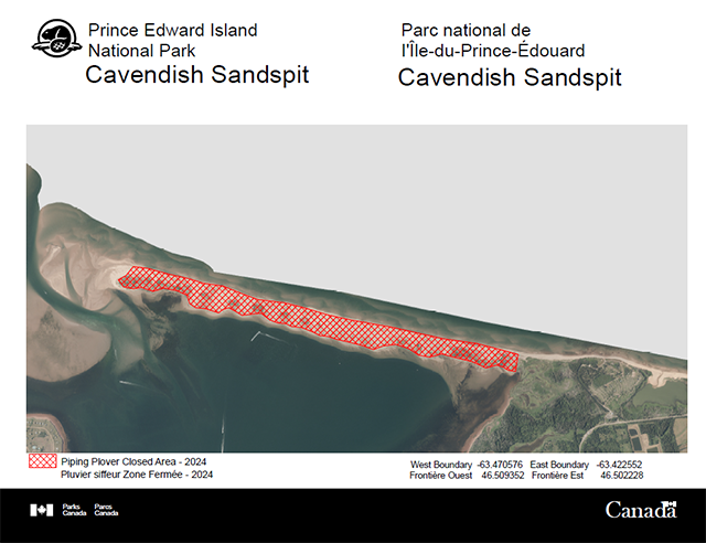 Piping Plover Closed Area - 2024 - West Boundary -63.470576 East Boundary -63.422552
Reason for Closure: The following area is nesting habitat for an endangered species, the Piping Plover(Charadrius melodus melodus). When Piping Plover are present and breeding, signs are posted and the area is closed to ALL PUBLIC USE AND TRAVEL by order of the superintendent, Prince Edward Island National Park of Canada pursuant to section 7(1),General Regulations of the National Parks Act. Beginning April 18th, 2024 until further notice.
Cavendish Sandspit: The sandspit from New London Bay to the Gulf of St. Lawrence between the following coordinates: west boundary longitude -63.470576 W and latitude 46.509352 N; and east boundary longitude -63.422552 W and latitude 46.502228 N. This closure extends to mean low tide along the north shore and mean high tide along the south shore.
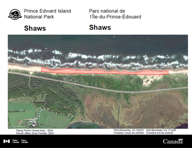 Piping Plover Closed Area - 2024 - West Boundary -63.190391 East Boundary -63.171248
Reason for Closure: The following area has been closed for dune restoration management and critical habitat use for the endangered Piping Plover (Charadrius melodus melodus). The area is closed to ALL PUBLIC USE AND TRAVEL by order of the superintendent, Prince Edward Island National Park of Canada pursuant to section 7(1), General Regulations of the National Parks Act. Beginning April 26th, 2024 until further notice.
Shaws Beach: The dune and beach to mean low tide east of Shaw's Beach from the western coordinates of 46.429998°, -63.190391° to the eastern coordinates of 46.429505°, -63.171248°. This closure extends to mean low tide along the north shore.
Brackley-Dalvay
Greenwich
Beach Closures for Bank Swallows
The following areas are nesting habitat for a threatened species, the Bank Swallow (Riparia riparia). When bank swallows are present and breeding, signs are posted and the areas are closed to ALL PUBLIC USE AND TRAVEL by order of the superintendent, Prince Edward Island National Park of Canada pursuant to section 7(1), General Regulations of the National Parks Act. The minimum fine for a violation of this prohibition is $150.
Current closures:
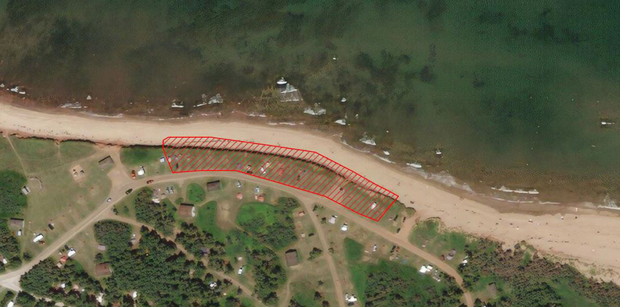
Cavendish-North Rustico
Cavendish Campground and Cavendish Campground Beach from the following coordinates: west boundary longitude -63.408058 and latitude 46.50182; and east boundary longitude -63.40609 and latitude 46.50153 to mean high tide.
Please note: this is a narrow stretch of beach directly in front of a Bank Swallow (Species at Risk: Threatened) nesting colony on the edge of Cavendish Campground and the beach. Visitors will still be able to access Cavendish Campground Beach on both sides of the closure, with lots of room to walk around it.
Related links
- Date modified :