
Photo spots
La Mauricie National Park
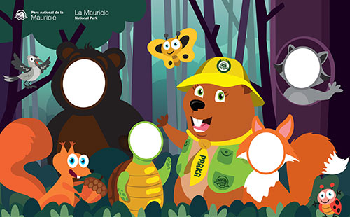
Look at the camera and "One, two, three, Wapi! "
It's all good and well to have an array of images committed to memory, but there's nothing better than a photo when you're sharing your experience with family and friends.
We have selected seven "coup de cœur" locations that will help you preserve the memory of your visit to the park.
Don't forget to share your photos!
#pnMauricie #lamauricienationalpark
Facebook.com/pnMauricie
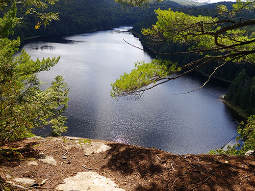
Le Passage Lookout
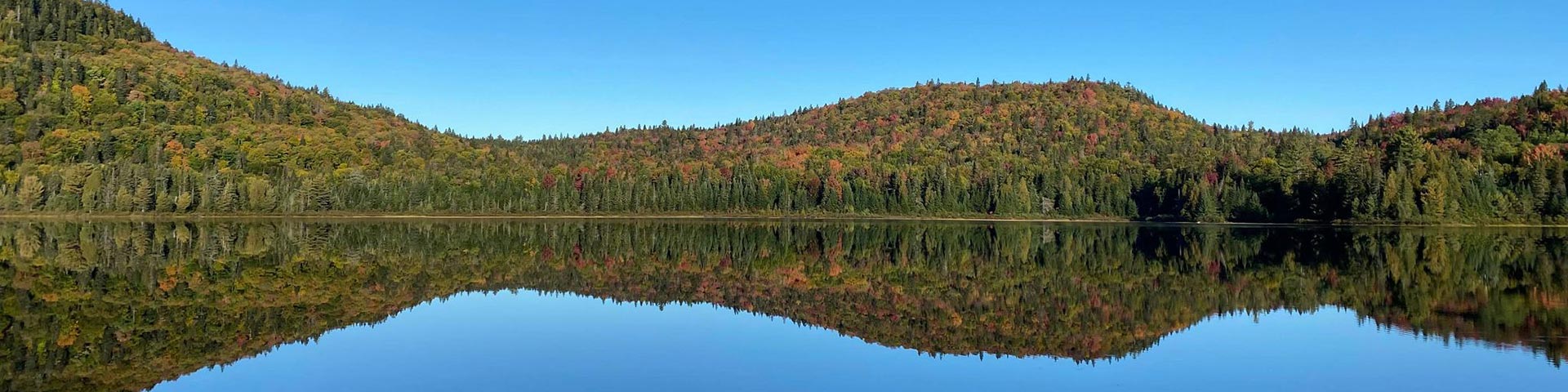
The Passage Lookout offers a spectacular view of the impressive Wapizagonke Lake. Halfway down Promenade Road, it's the perfect place to get out of the car, stretch your legs and take a picture.
GPS coordinates: 46.755262, -73.049524
How to get there:


Level of difficulty: easy
Walking distance one way: 100 m
Accessible by car, the lookout is located off Promenade Road. Situated 35 km from the Saint-Jean-des-Piles entrance and 28 km from the Saint-Mathieu entrance, a short 100 m paved trail will take you from the parking lot to the lookout.
Expert tip: Venture out early in the day; the sun isn't as strong and the lookout is less crowded.
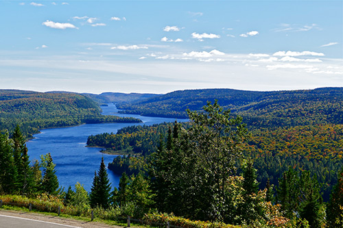
Anticagamac Lookout
Pack a lunch, bring along your camera and treat yourself to an unforgettable day in the great outdoors. When you arrive at the Anticagamac lookout, capture the moment against the backdrop of a truly authentic landscape.
GPS coordinates: : 46.773766, -73.125576
How to get there:

Level of difficulty: difficult
Distance to be navigated on the outward journey: 4.6 km
Walking distance one way: 3 km
Meet at the Wapizagonke picnic site, located about halfway between the Saint-Jean-des-Piles and Saint-Mathieu entrances. Launch your own boat (or rent one!) and cross the 3rd and 4th basins of Wapizagonke Lake (about 4.6 km). Go to the entrance of the Anticagamac portage and take the trail that will lead you to the lookout point, situated 3 km up the trail. If you feel like continuing on, about a kilometre further down is Waber Falls.
Expert tip: Point your camera at the cliff on your left to accentuate the effect of the mountains.
Bouchard Creek
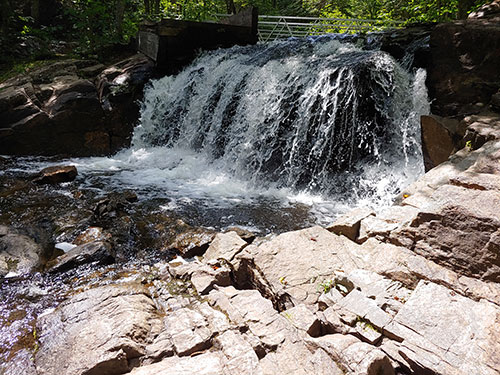
Few people can resist the charm of a waterfall and the Bouchard Creek waterfall is no exception.
GPS coordinates: 46.767433, -72.8214530
How to get there:
Level of difficulty: moderate
Walking distance one way: 1.9 km
Go to the back of the Rivière-à-la-Pêche service pavilion located 5 km from the St-Jean-des-Piles entrance and take Trail no. 6, following the signs for the Deux-Criques trail. The waterfall is located 1.9 km further down, at point B. The level is intermediate up to this point, but if you want a more intense challenge and have a bit of time on your hands, continue on the Deux-Criques trail.
Expert tip: To admire the full power of the waterfall, visit it in the spring.
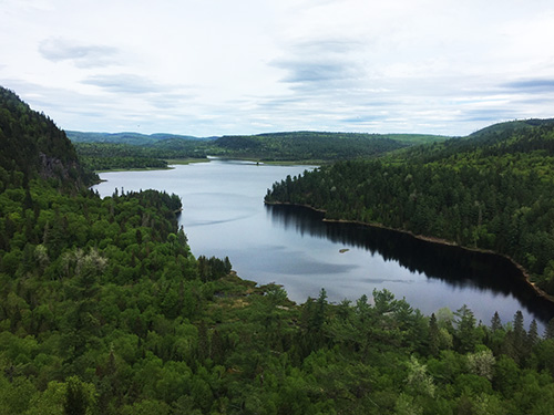
Lac Benoît Lookout
Accessible throughout the year, the Benoît Lake lookout point is worth the trip, whether by boat or in snowshoes.
GPS coordinates: 46.741810, -72.840468
How to get there:
Level of difficulty: difficult
Walking distance one way: 4.6 km
Walk behind the Rivière-à-la-Pêche service pavilion located 5 km from the St-Jean-des-Piles entrance and pass under the wooden arch. Take the Lac-du-Pimbina Trail (Trail no. 15) and you'll find the lookout point 4.6 km down the trail. You will then have the choice of continuing your hike for the remaining 8.5 km or retracing your steps.
Expert tip: In winter, when Lake Benoît is covered in snow, the landscape offers a striking contrast with the hikers' beautiful red cheeks!
Chute Parker
Parker Falls is known as one of the park's hidden gems. On the way, admire the buildings of the Domaine Wabenaki-Andrew, proud witnesses to the hunting and fishing club era.
GPS coordinates: 46.6804682, -072.868537
How to get there:
Level of difficulty: moderate
Walking distance one way: 4.1 km
From the Saint-Gérard entrance parking lot, take Trail no. 3. Once at the Domaine, follow the signs for Trail no. 8.
Expert tip: The waterfall is in full force in spring and as the water is still very cold. That means that few people are brave enough to go for a swim, leaving you with an 'intruder'-free' landscape.
Mekinac floating-bridge
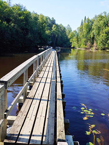
Who hasn't dreamed of walking on water? The floating bridge on the Mekinac trail gives you the chance.
GPS coordinates: 46.773606, -072.800701
How to get there:
Level of difficulty: moderate (easy until the footbridge stairs)
Walking distance one way: 2 km
Meet at the Mekinac day-use area parking lot located 4 km from the St-Jean-des-Piles entrance. On your way, you have the choice of two settings: one along the Saint-Maurice River and the other along a series of ponds that are a popular hangout for beavers. The footbridge is located 2 km from the parking lot and it is important to know that you will have to climb a staircase with many steps to reach it.
Expert tip: Take a comfortable break on one of the benches halfway along the bridge, your photo will certainly reflect a perfect zen moment.
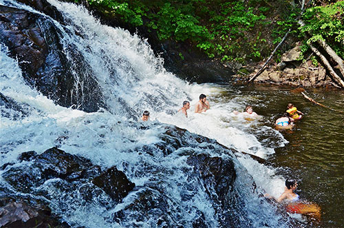
Pique-nique Shewenegan
The Shewenegan picnic area is a must; picnicking, swimming, hiking, canoeing... everything you need for an enjoyable day outdoors with the entire family. Keep a funny souvenir!
GPS coordinates: 46.672550, -73.005407
How to get there:
Level of difficulty: easy
Walking distance one way 300 m
The Shewenegan picnic area is located 4 km from the Saint-Mathieu entrance and the very short trail between the parking lot and the picnic area is paved.
Expert tip: Ask someone to take your picture; the whole family should jump in!
Related links
- Date modified :