Survey of Prince Edward Island National Historic Event
Holland Cove, Prince Edward Island
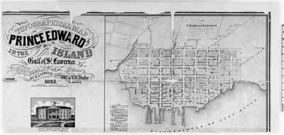
Topographical map of Prince Edward Island
© Expired
Address :
Highway 9, Holland Cove, Prince Edward Island
Recognition Statute:
Historic Sites and Monuments Act (R.S.C., 1985, c. H-4)
Designation Date:
1932-05-30
Dates:
-
1764 to 1766
(Significant)
Event, Person, Organization:
-
Captain S. Holland
(Person)
Other Name(s):
-
Survey of Prince Edward Island
(Designation Name)
Importance:
Survey of Prince Edward Island and coastal waters by Captain S. Holland, 1764-66
Plaque(s)
Existing plaque: 200' from the entrance to Port-La-Joye-Fort Amherst NHS Highway 9, Holland Cove, Prince Edward Island
Following the Treaty of Paris, 1763, the British Government ordered a systematic survey of its possessions in North America. Captain Samuel Holland was placed in charge of the district north of the Potomac and, because of the importance of the fisheries, was instructed to begin with Prince Edward Island. In October, 1764, he established his headquarters at Holland Cove and completed his survey of the Island in 1765.