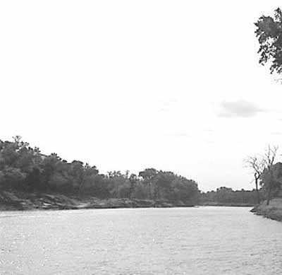
Fort Dufferin National Historic Site of Canada
Emerson, Manitoba

General view
© Parks Canada Agency / Agence Parcs Canada.
Address :
Highway 75, 3 miles north of Emerson, Emerson, Manitoba
Recognition Statute:
Historic Sites and Monuments Act (R.S.C., 1985, c. H-4)
Designation Date:
1937-05-20
Dates:
-
1872 to 1873
(Construction)
-
1875 to 1879
(Significant)
-
1874 to 1874
(Significant)
-
1872 to 1875
(Significant)
Event, Person, Organization:
-
North West Mounted Police and the March West
(Event)
-
James Morrow Walsh
(Person)
-
George Mercer Dawson
(Person)
-
Captain Donald Cameron
(Person)
-
Commissioner George A. French
(Person)
-
William Hespeler
(Person)
-
North American Boundary Commission
(Organization)
-
Captain Arthur C. Ward
(Architect)
Other Name(s):
-
Fort Dufferin
(Designation Name)
-
March West
(Plaque name)
Research Report Number:
2002-079, 2005-SDC/CED-081
DFRP Number:
56581 00
Plaque(s)
Existing plaque: Remains of Fort Dufferin, Highway 75, 3 miles north of Emerson, Emerson, Manitoba
Established in 1872, Fort Dufferin was essential to events asserting Canada’s sovereignty over Manitoba and the North-West Territories. The complex was initially the headquarters for the British-Canadian contingent of the North American Boundary Commission surveying the 49th parallel and was used as the assembly point for the North-West Mounted Police’s “March West” on July 8, 1874. It later served as an immigration station for Manitoba’s southern border from 1875 to 1879, becoming a gateway for some 18,600 settlers of diverse origins who entered these newly surveyed lands by steamboats on the Red River.
Description of Historic Place
Located in a rural area north of the town of Emerson, Manitoba, on the west bank of the Red River, Fort Dufferin National Historic Site of Canada consists of the remains of a complex of buildings that was used as the main camp for the North American Boundary Commission (NABC) from 1872. It was then used by the North West Mounted Police (NWMP) in preparing for the March West and as a police post during the winter of 1875. Official recognition refers to the remains of the core complex of buildings, four standing buildings (referred to as the mess kitchen, storage building, stable and latrine), at least twelve depressions (former cellars, pits and semi-subterranean buildings) and landscape features.
Heritage Value
Fort Dufferin was designated a national historic site of Canada in 1999 because: it supported the assertion of Canada’s sovereignty over Manitoba and the North-West Territories between 1872 and 1879; it was a pivotal location of operation for the British-Canadian contingent of the North American Boundary Commission in its work to define and mark the 49th Parallel from the fall of 1872 to the winter of 1874; it was the site where the newly formed North-West Mounted Police assembled and on 8 July 1874, set out on its famous “March West”; and, it functioned as Manitoba’s southern border immigration station from 1875 to 1879, receiving more than 18,600 people of diverse origins.
Beginning in 1872, Fort Dufferin served as the base of field operations for the North American Boundary Commission, which worked for the next two years to define and mark the 49th Parallel. Subsequently, the North West Mounted Police used Fort Dufferin on two separate occasions, first in 1874 as the marshalling area for the “March West” and then in the winter of 1874-1875 as the headquarters of ‘D’ Division. Between 1875 and 1879, Fort Dufferin served as a port of entry to Manitoba and gateway to western Canada. Fort Dufferin’s role as immigration station lasted only as long as boats on the Red River were the main mode of transport for immigrants to Manitoba. The property subsequently served as a livestock quarantine station before being sold to private owners, and then finally to the Province of Manitoba.
Sources: Historic Sites and Monuments Board of Canada, Minutes, December 2005; Commemorative Integrity Statement, January 2007.
Character-Defining Elements
Key elements contributing to the heritage value of this site include: its location along the bank of the Red River, near Emerson Manitoba; its relatively isolated setting within a meadow in the riparian forest along the Red River; the original, basic 1872 structure of the Mess Kitchen on its mudsills and its original frame construction and finishes under layers of later material, situated in its original location; the standing storage building, stable and latrine which bear materials and framing indicative of North American Boundary Commission construction and have partial dimensions approximating historic NABC buildings; the above and below ground evidence of archaeological remains relating to the 1874-1879 period; the integrity of any surviving or as yet unidentified archaeological remains which may be found within the site in their original placement and extent; the viewscapes to and from the Red River and surrounding fields.