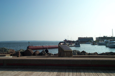
Survey of the Gulf and River of St. Lawrence National Historic Event
Charlottetown, Prince Edward Island

Survey of the Gulf and River of St. Lawrence
© Parks Canada
Address :
Great George Street, Charlottetown, Prince Edward Island
Recognition Statute:
Historic Sites and Monuments Act (R.S.C., 1985, c. H-4)
Designation Date:
1935-05-29
Other Name(s):
-
Survey of the Gulf and River of St. Lawrence
(Designation Name)
-
(Special Name (in French))
Importance:
Captain Henry W. Bayfield produced first accurate charts, 1827-56
Plaque(s)
Existing plaque: On wharf located off Great George St Great George Street, Charlottetown, Prince Edward Island
Between 1827 and 1856 the first complete hydrographic survey of the Gulf and River St. Lawrence was carried out by Captain Henry W. Bayfield and his assistants. From the time of Cartier, French and British navigators ad surveyed these waters and produced charts, but by the 1820s these waters and produced charts, but by the 1820s these had become inadequate to the changing needs of shipping. The charts and sailing directions produced from Bayfield's work were the authority for the area until the 20th century. His relentless pursuit of accuracy set the standard for the Canadian Hydrographic Service, founded in 1883.