Nahanni National Park Reserve
Northwest Territories
Date of Inscription: 1978
Prospectors started searching the South Nahanni River in the Northwest Territories for gold a century ago. They found little. But they did encounter vast reaches of the most varied and spectacular environment imaginable - towering mountains and tundra plains, wetlands and sand dunes, badlands and luxuriant forests, grizzly bears and trumpeter swans. There are steaming hot springs and complexes of caves, some lined with ice crystals, others with colourful stalagmites and stalactites.
Justification of outstanding universal value
Nahanni National Park was designated as a World Heritage site by UNESCO’s World Heritage Committee under the following criteria:
Criterion (vii): The Nahanni River is one of the most spectacular wild rivers in North America, with deep canyons, huge waterfalls, and spectacular karst terrain, cave systems and hot springs. Exposure of geologic and geomorphologic features includes the meanders of ancient rivers, now raised high above present river levels.
Criterion (viii): In Nahanni National Park, there is exceptional representation of on-going geological processes, notably fluvial erosion, tectonic uplift, folding and canyon development, wind erosion, karst and pseudo-karst landforms, and a variety of hot springs. The major geologic and geomorphologic features provide a combination of geological processes that are globally unique.
Full description
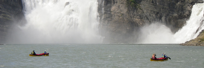
And everywhere rivulets and streams and rushing rivers, all feeding the restless, prodigious South Nahanni, alive with frenzied rapids and whirlpools, with meanders and braids, crashing over the cataract of Virginia Falls, twice the height of Niagara Falls, cutting for kilometres through canyons 1,000 metres deep, then bending through a tortuous constriction called Hell’s Gate.
Today, remarkably, nothing has changed. The South Nahanni still swirls and crashes, the hot springs steam, the grizzlies prowl. This is a wilderness largely unmodified by humans. Indeed, running water remains the major agent of change. Rivers cut canyons through the Mackenzie Mountains and spread alluvial fans. And since the region escaped glaciation during the last Ice Age, canyon walls remain sharp and deep, neither widened nor smoothed by grinding ice.
Related links
- Anticosti, Quebec
- Tr’ondëk-Klondike, Yukon
- Writing-on-Stone / Áísínai’pi
- L’Anse aux Meadows National Historic Site
- Dinosaur Provincial Park
- Kluane / Wrangell-St.Elias / Glacier Bay /...
- Head-Smashed-In Buffalo Jump
- SG̱ang Gwaay
- Wood Buffalo National Park
- Canadian Rocky Mountain Parks
- Historic District of Old Québec
- Gros Morne National Park
- Old Town Lunenburg
- Waterton-Glacier International Peace Park
- Miguasha National Park
- Rideau Canal
- Joggins Fossil Cliffs
- Landscape of Grand Pré
- Red Bay Basque Whaling Station
- Mistaken Point
- Pimachiowin Aki
- Date modified :