
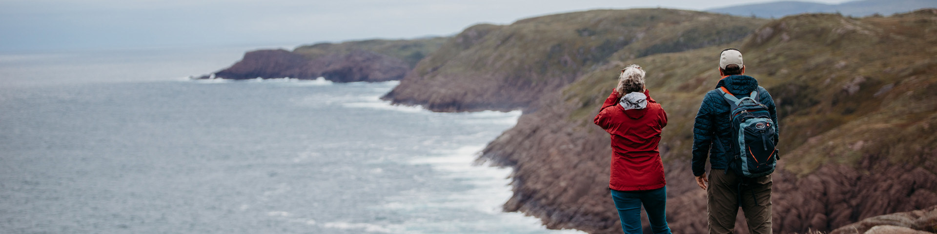
Hiking
Cape Spear Lighthouse National Historic Site
While walking the trails at Cape Spear National Historic Site you are sure to see captivating views and panoramic scenery!
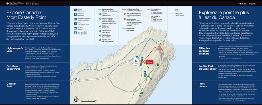
Image Text (or click the image to enlarge)
Explore Canada’s Most Easterly Point
Welcome to Cape Spear Lighthouse National Historic Site, Canada’s Most Easterly Point! We have 3 amazing trails for you to explore, but request that all visitors stay on designated trails during their visit. Doing so will help protect sensitive local native plants, reduce erosion, and keep you safe from dangerous coastal rocks and cliffs. Stay safe and enjoy your visit!
Lightkeeper’s Lane
This trail will bring you to the Modern Light Tower, the Canadian Coast Guard Alumni Association’s Art Gallery, and then all the way to the original 1836 Lighthouse.
- 1 km walk taking roughly 30 minutes one way.
- Consists of many staircases, boardwalks and gravel paths.
- Provides access to the East Coast Trail.
Fort Cape Spear Path
This trail will take you to Canada’s Most Easterly Point and the remains of Fort Cape Spear.
- 0.5 km walk taking roughly 15 minutes one way.
- Relatively level path consisting of a paved path as far as the Most Easterly Point.
- Connects to Lightkeeper’s Lane and the Coast Trail.
Coastal Trail
Hike along the rugged coastline and take in the amazing sights this trail has to offer. Be sure to stop frequently to scan the horizon for whales, icebergs, and marine birds.
- 1.5 km walk taking roughly 45 minutes one way.
- Consists of sections of boardwalks, gravel paths, and rough, rocky areas.
- Terminates at the Most Easterly Point Lookout, where it connects to Fort Cape Spear Path.
There are two sections of the East Coast Trail system that connect to Cape Spear: The Blackhead Path and the Cape Spear Path. For trail descriptions and more information about the East Coast Trail Association, visit their website.
Be prepared! Don't forget appropriate footwear and a bottle of water!
| Trail | Difficulty | Distance | Time | Description |
|---|---|---|---|---|
| Blackhead Path | Moderate | 3.7 km (one way) | 1.5 hours | A scenic climb and descent, rough underfoot, great views back to the cliffs of Southside Hills, Cabot Tower and on to Cape Spear and the Cape Spear lighthouses. Note this path has mostly low growth and is very exposed to weather (think fog, wind, rain). |
| Cape Spear Path | Moderate | 10.3 km (one way) | 4-6 hours | A beautiful outing with variety of terrain, hills, long views, boardwalked bog crossing at Staffordside, erratics along the shore, two river crossings. Trail passes through a Nature Conservancy of Canada protected property in Maddox Cove. Often windier, cooler and damper, than weather in St. John's. |
- Date modified :