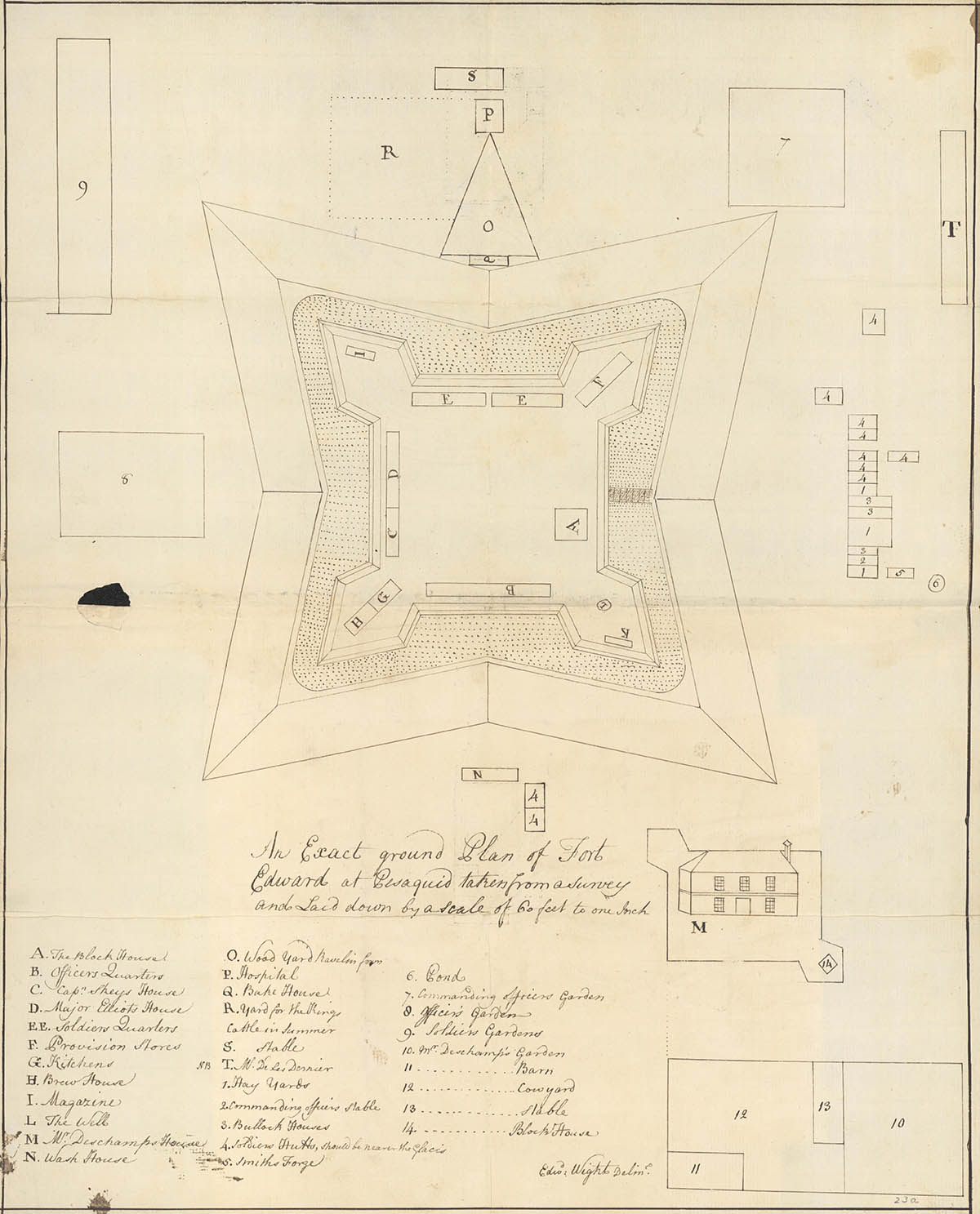
An exact ground plan of Fort Edward at Pesaquid, 1758
Fort Edward National Historic Site
An exact ground plan of Fort Edward at Pesaquid taken from a survey and laid down by a scale of 60 feet to one inch.
The plan shows the defences included a blockhouse, barracks for soldiers and officers, provisions stores, a powder magazine, and service buildings.
The fort was protected by earth ramparts, a wooden palisade, and a ditch.
Outside the ramparts on the hillside were small gardens, stables for cattle and horses, a hospital, a forge, and huts for some of the soldiers.
There was also a truckhouse, which was a government-sanctioned trading post set up to facilitate trade with the Mi'kmaq.

Legend
Inside the ramparts
A – The Block House
B – Officers Quarters
C – Captain Skeys House
D – Major Elliots House
EE – Soldiers Quarters
F – Provision Stores
G – Kitchens
H – Brew House
I – Magazine
L – The Well
Outside the ramparts
At the bottom of the map
M – M. Deschamp's House
N – Wash House
4. Soldiers Hutts, should be nearer the glacis
10. M. Deschamp's garden
11. M. Deschamp's barn
12. M. Deschamp's cowyard
13. M. Deschamp's stable
14. M. Deschamp's Blockhouse
On the left side of the map
8. Officers garden
9. Soldiers gardens
At the top of the map
O – Wood Yard Ravelin form
P – Hospital
Q – Bake House
R – Yard for the things — Cattle in summer
S – Stable
On the right side of the map
T – W. De Les Dornier
1. Hay Yards
2. Commanding Officers Stable
3. Bullock Houses
4. Soldiers Hutts, should be nearer the glacis
5. Smiths Forge
6. Pond
7. Commanding Officers garden
Related links
- Date modified :