
Paddling Route: Campbellford to Glen Ross
Trent-Severn Waterway National Historic Site
Southern region 2-day route
Paddle along the Trent-River staring with your first lockage at the Ranney Falls flight lock. Take this trip to the next level by booking a night’s stay in the one-of-a-kind Parks Canada Ôasis.
Route information
- Difficulty: Intermediate
- Total distance: 30 km (19 miles) total; one way
- Day 1 - Campbellford to Lock 8 - 11.5 km (7 miles)
- Day 2 - Lock 8 to Lock 7 - 18.5 km (12 miles)
- Time to paddle: 2 days; 7 to 9.5 hours total
- Day 1 - 2.5 to 3.5 hours
- Day 2 - 4.5 to 5 hours
- Number of locks encountered: 6
- Environment: Urban paddling for a short section to start; then gentle river
Facilities and services available along this route:
-
 Lockage (recommended)
 -
 Accessible washrooms
  Potable water
 Information
-
 Picnic area
 -
 Camping
COVID-19
Some lockstation facilities and services have changed in response to the COVID-19 pandemic and could affect your visit. Please visit our COVID-19 information page for more details when planning your trip.
Plan your trip
This is a one-way route that requires a personal shuttle to or from the put-in and take-out locations. Plan accordingly.
Put-in locations
Suggested:
- Floating dock at lower reach of Lock 13
Location: 6199 County Rd 50, Campbellford, ON
Other locations to put-in nearby:
- Boat launch (64 Trent Drive, Campbellford)
- Campbellford Paddle
- Boat launch at Ferris Provincial Park
- Trent Dr. (Upper reach of Lock 11/12)
Take-out locations
Suggested:
- Glen Ross Public Boat Ramp
Location: 123-33 Blacksmith Ln, Frankford, ON
Other locations to take-out nearby:
- Floating dock at the upper and lower reach of Lock 8
- Floating dock at the lower reach of Lock 7 Glen Ross
Camping & Accommodations
Three lockstation options:
- Lock 9 - Meyers or Lock 10 - Hagues Reach
- Tent camping
- Ôasis
- Lock 8 - Percy Reach
- Tent camping
- Reservable campsites
Tent camping is available at most lockstations on a first-come, first-served basis, at the discretion of the lockmaster. Only campsites at Lock 8 can be reserved in advance.
Learn more about camping at lockstationsPaddling directions
- Depart Lock 13 and paddle south to Lock 8
- From Lock 8, continue following the channel of the Trent River passing by Hickory Island until you reach the Glen Ross Public Boat Launch located near the dam before Lock 7 - Glen Ross
Lockage
Lockage is recommended for several locks along this route. Portaging may be difficult.
Lockage is the process of raising or lowering boats and paddlecraft into connecting sections of the Trent-Severn Waterway. Lockage takes approximately 20 minutes to complete. During seasonal Hours of Operation, paddlers can lock through any Parks Canada lock with the purchase of a valid lockage permit. Permits may be purchased upon arrival, or in advance online or by phone.
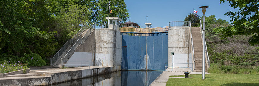
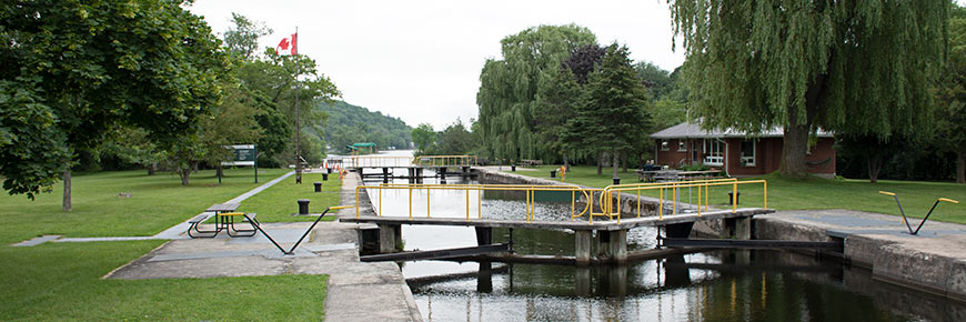
Locks along this route
The status of facilities and services at lockstations listed below are subject to change throughout the navigation season. Please visit our 2021 Facilities and Services page for up-to-date status by lockstation.
Wind conditions
- The water flows from Campbellford to Glen Ross
- Preferable wind conditions from Campbellford to Percy Reach are from the north (tail wind)
- Preferable wind conditions from Percy Reach to Glen Ross are from the west (tail wind)
- Avoid winds from the south (head wind) between Campbellford to Percy Reach
- Avoid east winds (head wind) and strong north/south winds (cross winds) in wider sections of the river from Percy Reach to Glen Ross
Hazards
- Watch for powerboats and their wake
- Be aware of ongoing construction at Lock 13
Avoid dams
Watch for dams at the following locations and be sure to navigate away from them:
- 0.5 km after bridge of left side (east shore)
- 1.45 km after Lock 11/12 on right side (west shore) with power house 0.2 km after dam
- 2.4 km after Lock 10
- At the Glen Ross public boat launch
Tourism information
Nearby communities and services
- Campbellford
- Dining and shopping within walking distance of river
- Glen Ross
Points of interest
- Campbellford cenotaph - Community War memorial
- Giant Toonie in Old Mill Park
- Ranney Falls
- Ranney Gorge Suspension Bridge
- Ferris Provincial Park
- Locks 11/12 Ranney Falls
- NEW: Oasis overnight accommodations at lower reach of Lock 9
- Sunken gates at lower reach of Lock 9 of left side (east shore) in the little cove
- Centennial Trail between Lock 8 - Percy Reach and Lock 9 - Meyers
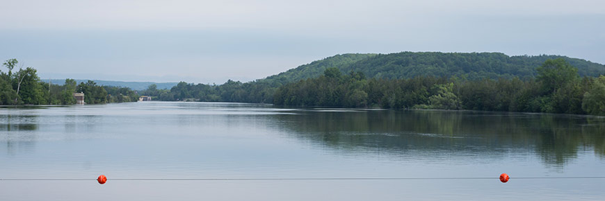
- Bradley Bay on the Trent River marks the Southern edge of The Land Between - the ecotone that is a transition zone between the Canadian Shield to the North and the Saint Lawrence Lowlands to the South
- Hickory Island is about 2km long. Once you reach the north eastern tip you can explore the island’s wetlands
- There is a lot of shoreline to explore in the Blue Hole and around smaller islands as you make your way around Hickory Island
Regional tourism information
The following regional tourism experts can help guide you towards great local experiences and businesses in the areas along this route. Visit their websites when planning your trip.
- Kawarthas Northumberland
- Trent Hills
- Trent Hills Chamber of Commerce
- Bay of Quinte Tourism
- Belleville Chamber of Commerce
- Quinte West Chamber of Commerce
Videos
Parks Canada on Youtube
Videos by others
Other routes you might like…
- Date modified :