Water hazards
Pacific Rim National Park Reserve
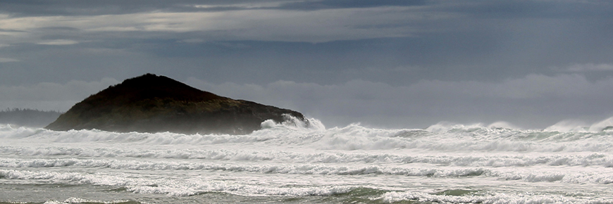
Visitors to Pacific Rim National Park Reserve are responsible for their own safety and must use extreme caution when swimming, surfing or engaging in any water activity. Learn how to identify water hazards and prevent injury so you can enjoy the park safely.
Hypothermia
The water may look inviting, but it is cold. Even in summer, Pacific Ocean water temperatures range from 7C to14C. Maximum survival time in water this cold is two to three hours. Know the signs of hypothermia and wear a wetsuit at all times.
Prevent hypothermia
- Prepare for the weather:
Pack equipment and extra clothing in waterproof containers. Think ahead, know the forecasted weather conditions. Assess changing conditions and adjust your plans accordingly. - Bring appropriate clothing:
This includes waterproof rain gear, layers that provide warmth even when wet, and hats and gloves. - Know the skills and abilities of all members of your party:
Do not let anyone become exhausted, their ability to stay alert and orientated will decrease. Take breaks and stay warm. - Remember to eat:
The body needs the energy from food to create warmth. Keep a supply of high-energy food accessible.
- Be alert to the first signs of hypothermia:
Act immediately.
Progressive symptoms of hypothermia
- You feel cold and you have to exercise to stay warm.
- Your start to shiver and feel numb.
- Your shivering intensifies.
- You have difficulty speaking.
- You find it hard to think.
- Your muscle co-ordination becomes difficult.
- Your pulse and respiration slow.
- You lose consciousness.
- Your heart beat becomes erratic.
- Heart, lung and brain stop functioning.
- Death.
Large waves
All Pacific Rim beaches are exposed to the power of the open Pacific Ocean. Waves (also called swell), can be affected by local factors, like tides, winds, and currents, as well as storms and weather systems thousands of kilometres away.
In the water:
Large waves mean that ocean conditions may change rapidly and create conditions that can overwhelm surfers, swimmers and kayakers. For example, a large swell may increase rip currents.On beaches:
swell means that large waves can unexpectedly sweep over beaches and rocky shorelines, causing beaches to flood, and drift logs to float and roll.Be prepared
- Consult a tide table, the swell forecast, and the park’s Wave Hazard Rating before starting your shoreline hike or water activities.
- Inquire about surf forecasts and known local hazards at the park’s visitor centre or local surf shops.
- The larger the waves, the greater the danger. Wave conditions change rapidly. If in doubt, do not go out.
Rip currents
Rip currents are powerful, fast-moving currents of water that can pull even the strongest swimmer out to sea. Rip currents form when waves push large volumes of water onto the shore and the water returns towards the ocean through gaps in underwater sand bars, behind islands or beside rocky headlands.
How to identify a rip current:
Look for a narrow stream of water moving quickly away from the shore. The surface of this patch of water looks smooth with a choppy rippled effect. Waves are breaking on either side of the patch of water but not inside it.
What to do if you get caught in a rip current:
- Don't fight the current.
- Swim out of the current parallel to the shore, then swim to shore.
- If you can't escape, float or tread water.
- If you need help, call or wave for assistance.
Tides
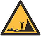
Twice each day, the shores of Pacific Rim become wide as the tide goes out, and then narrow again as the tide comes in. Tides are caused by the gravitational attraction of the sun and moon. Tides can also be influenced by wind and storms. Tides here range from a few centimetres to over three metres.
Be prepared
- Plan your seashore activities according to the tides.
- Be aware and watch the rising tide along your route to ensure that you can safely return the way you came.
- Keep track of time.
- Ask Parks Canada staff for information about tides.
Rolling beach logs
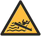
While beached drift logs can provide a vantage point or great picnic spot, high tides and large waves can transform them into deadly hazards. Drift logs can float and roll, knock you off your feet, trap you beneath them, or roll over and crush you. During rainy weather, drift logs are also extremely slippery.
Be prepared
- Respect the ocean’s power and stay off the beaches and drift logs if the tide or swell is high.
- Observe the conditions closely before you step out onto the beach.
- Consult a tide table, the swell forecast, and the park’s Wave Hazard Rating before your shoreline activities.

Tsunamis
Tsunamis are a series of unusually big waves caused by a large-scale disturbance of a body of water. Earthquakes are a primary cause of tsunamis, but tsunamis can also be caused by near-shore and underwater landslides, near-shore and underwater volcanoes, man-made explosions, and even by space objects impacting water bodies.
Two main types of tsunami threats in BC:
- Tsunamis generated out in the Pacific Ocean
These tsunamis could severely impact BC’s outer coastal areas with waves from the north, south or west.
- Tsunamis generated in local waters
These local tsunamis can be triggered by earthquakes, landslides and/or underwater slides and can have an impact on other coastal areas of British Columbia.
What to do if there is a tsunami warning:
- If you feel strong shaking from an earthquake or if the water suddenly recedes, move immediately to higher ground (greater than 15 metres or 45 feet above the tide line). Follow the Tsunami Evacuation route signs to an area of refuge.
- If you hear a tsunami warning or bulletin, follow information and instructions from emergency officials immediately.
- Do not go to the beach to watch. Remember, not all areas of the coastline will be impacted equally. The impact of a tsunami can vary considerably within a very short distance. In as little as one kilometre, depending on the shoreline shape and the direction of the wave, there could be tens of metres difference in the impact of the tsunami.
For more information, visit Coastsmart.ca and PreparedBC - Tsunamis.

Red Tide
The world's water—fresh and marine—contains a large variety of single-cell plants called microalgae. The individual plants are usually so small they require a microscope to be seen. When conditions are right, often in the summer in this area, one species of algae will multiply in great numbers. This is called a plankton bloom.
Depending on the most common species of algae in the bloom, the water colour may change. In this area blooms are often brown, red or blue. Many of the blooms in marine waters are red which has lead to the common term red tide.
How it affects you:
Many of the red tide algae produce toxins. Different toxins are produced by different algae. Some toxins have a big impact on fish, others on mammals. The algae which is responsible for paralytic shellfish poisoning (PSP) is in the group of algae called Gonyaulax. These algae produce an extremely potent toxin, which affects nerve impulses and can lead to paralysis of muscles and may eventually end in asphyxiation.
Warm-blooded animals are particularly sensitive to this toxin. Shellfish, such as clams, mussels, and oysters can feed on the algae with no ill effect. However, their tissue will accumulate the toxin when they feed on the algae. The problem for humans occurs when we eat shellfish that has accumulated large quantities of the toxin in their tissue. Shellfish containing the toxin do not appear different than shellfish that do not contain the toxin. In our area Fisheries and Oceans Canada regularly test shellfish for this toxin.
If you are considering harvesting shellfish:
Honour all Fisheries and Oceans Canada PSP notices and consumption closures. Warnings are posted for visitor safety, not for conservation purposes. Please ensure you consult your salt water fishing regulations for park specific shellfish limits and note that the National Park is a volunteer no-harvest zone.
- Date modified :