Winter safety
Kluane National Park and Reserve
Winter can be a hazardous time for backcountry wilderness travel. You are responsible for your own safety and should file a travel plan with a friend or family member whether heading out for the day or on a multi-day trip.
Emergencies
You are encouraged to a carry satellite phone or satellite GPS messenger device, such as a SPOT® or inReach® as cell phones are out of range in most areas of the park. In the event of an emergency, you should be prepared for lengthy delays in search and rescue response times due to weather conditions and/or the availability of both aircraft and rescue personnel.
Parks Canada 24 Hour Emergency Dispatch
1-780-852-3100
Be prepared

In the backcountry, your safety is your personal responsibility. While many hazards exist, the risk of personal injury you face can be minimized by taking reasonable precautions. Caution and self-reliance are essential, along with a knowledge of natural hazards, experience in avoiding them and successfully dealing with them when they happen. Pick trips that reflect your level of ability.
A few tips:
- Travel with caution – You may encounter overflow (water under the snow layer), thin ice or open water on any of the lakes, rivers or creeks in the area
- Never travel alone – groups of two or more have much greater success dealing with emergencies
- File a trip plan – let someone at home know your plans, even for a day trip.
- Do not overexert yourself – the possibility of hypothermia is greatest when the body is tired and cold.
- Prevent snow-blindness – wear sunglasses.
- Carry emergency equipment – fire starter, spare clothing, a repair kit, a survival kit, and a first aid kit.
- Carry a satellite phone or satellite GPS messenger device – most cell phones are out of range in the park
- Dress for the conditions you expect and be prepared for weather changes. Wear layers of clothing, adding or shedding layers as needed.
- Check weather forecasts
Hypothermia
Hypothermia is the lowering of the interior body temperature, and is caused by exposure to the cold, aggravated by wetness, wind and personal exhaustion. Hypothermia can be fatal.
Symptoms
Hypothermia symptoms can be recognized in an individual by:
- Uncontrollable fits of shivering
- Slurred speech
- Stumbling
- Loss of coordination
- Difficulty performing simple tasks
- Behaviour may also change: a good-natured person may begin to grumble and complain
Prevention is the best cure:
- Layer clothing appropriate for the weather – remove and add as necessary
- Protect your head from heat loss - wear a hat
- Don't eat snow - Your body has to melt and warm the snow resulting in a drop in body temperature
- If needed start a fire, drink warm beverages (not alcoholic), eat chocolate or other high calorie food, put on dry clothes and get into a sleeping bag/tent if required
Emergency treatment
- If possible move the patient to medical assistance quickly
- If this isn't possible, move the victim to a shelter, remove the victim's clothes, place a naked person on each side of the patient and keep all three well covered
- If the patient is conscious, give them warm liquids (not alcoholic)
Frostbite
Frostbite is the freezing of the body tissues. There is a sensation of numbness, the skin turns white, yellow-white and mottled blue-white and the area becomes cold and insensitive to touch. The nose, ears, cheeks and chin are usually parts of the body to be affected, but more severe cases of frostbite involve the hands and feet.
Treatment
Minor frostbite:
- Add more clothing to the affected area and shelter from the cold
- Rewarm the area with body heat, but do not massage
Serious frostbite:
- Prevent further freezing
- Don't thaw the frozen area if there is a danger of refreezing
- If freezing can be prevented, rewarm the area by immersing it in water, starting at a comfortable hand temperature and increasing the temperature gradually
- Get medical aid as quickly as possible
- Keep the area clean at all times, as risk of infection is great
Ice safety

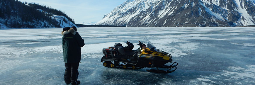
Use caution when traveling or recreating on frozen lakes and rivers, particularly in the early winter and late spring. Parks Canada does not test the ice thickness or quality. Be cautious when considering any activities on lake or river ice, and be sure to check the ice frequently.
Do not use the ice unless you measure a minimum of:
- 10 cm / 4 inches for skating, ice fishing, walking, cross country skiing
- 12 cm / 5 inches for one snowmobile (only permitted on Kathleen Lake)
Check AdventureSmart for ice safety tips.
Avalanche hazard
Avalanches are one of the most significant threats in mountainous terrain during the winter months. Snow avalanches happen when a combination of factors, including the amount of snow accumulated on a slope, the steepness of the slope, and the changes to the snowpack caused by wind, sun, temperature and precipitation, cause the bond within the snowpack or between the snowpack and the ground to weaken to the point that the snowpack can no longer hold itself together.
The highest avalanche danger usually exists during or immediately after a heavy snowfall, with prolonged periods of high winds, or sudden temperature changes (rapid warming to above freezing temperatures).
Where do avalanches happen?
Avalanches are most common on slopes between 25-45 degrees. Even when travelling in flat areas such as creeks and gullies, the slopes above can be dangerous. Open slopes in the forest that are bare of trees can be regular avalanche paths. All travelers must be aware when they are traveling in avalanche terrain.
How to prepare for safe travel in avalanche terrain
Anyone thinking about travelling in avalanche terrain should first take a certified Avalanche Skills Training course. For more information contact the Canadian Avalanche Centre. It is strongly recommended that each member of the party be equipped with shovels, probes, and avalanche beacons, and be knowledgeable in avalanche search and rescue procedures.
Avalanche Terrain Exposure Scale (ATES)
The Avalanche Terrain Exposure Scale is used by Parks Canada to offer a distinction between the risk exposures of the different backcountry trips within National Parks. This system rates the terrain not the snow conditions, since snowpack changes continuously throughout the winter season, and the terrain the snowpack sits on does not. By using the ATES, backcountry travelers can improve their understanding of the type of avalanche terrain that threatens their proposed outing.
No avalanche terrain (Dezadeash River Trail, Mush Lake Road, Kathleen Lake Area, Forestry Trails)
ATES - Simple - Class 1
Exposure to low angle or primarily forested terrain. Some forest openings may involve the run-out zones of infrequent avalanches. Many options to reduce or eliminate exposure. No glacier travel.
ATES - Challenging - Class 2 – (Auriol Trail, St Elias Lake Trail)
Exposure to well defined avalanche paths, starting zones or terrain traps; options exist to reduce or eliminate exposure with careful route finding. Glacier travel is straightforward but crevasse hazards may exist.
ATES - Complex - Class 3 – (Cottonwood Trail)
Exposure to multiple overlapping avalanche paths or large expanses of steep, open terrain; multiple avalanche starting zones and terrain traps below; minimal options to reduce exposure. Complicated glacier travel with extensive crevasse bands or icefalls.
- Date modified :