
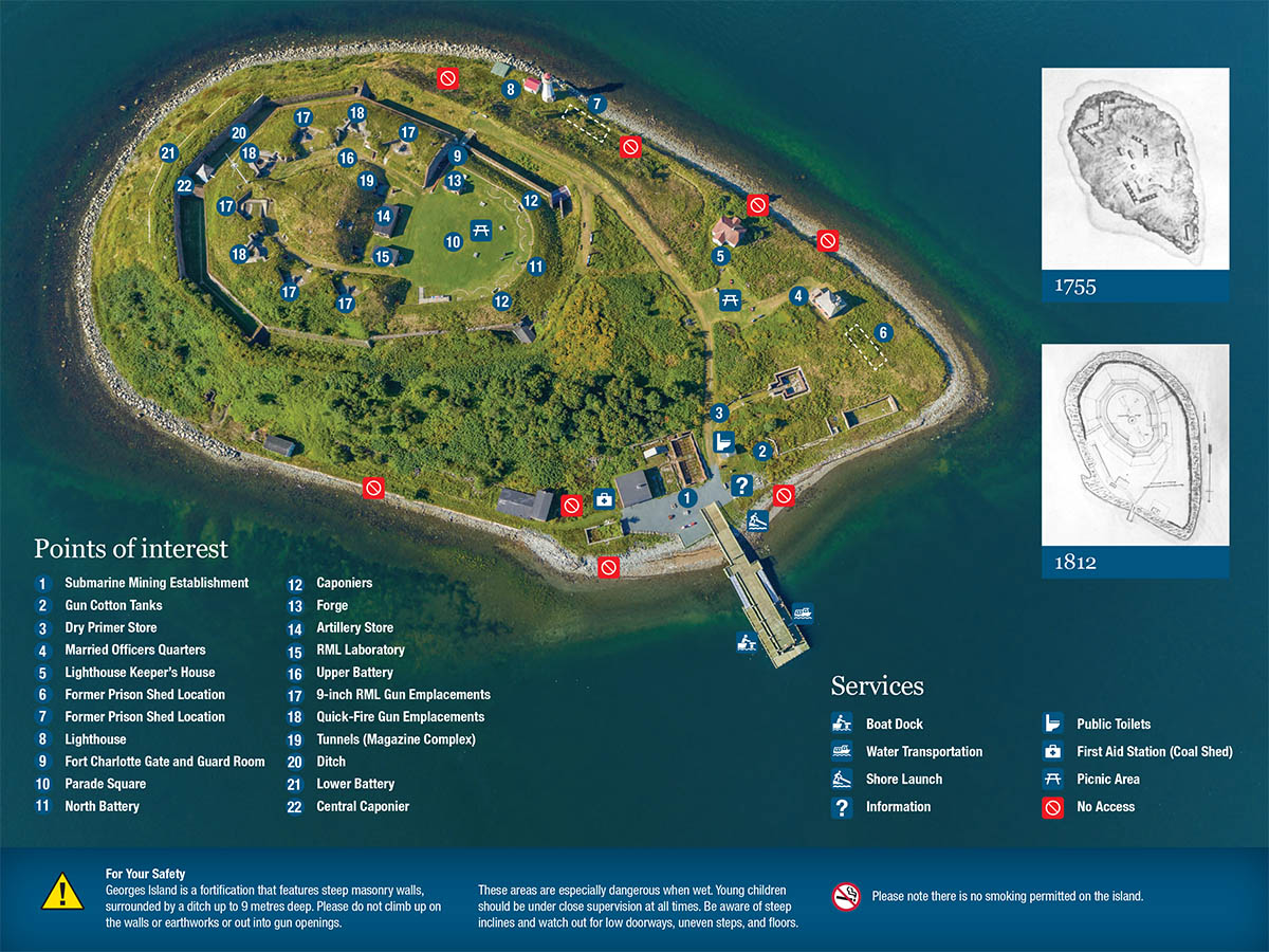
Map of Georges Island National Historic Site
Georges Island National Historic Site
This map shows the points of interest and services offered at Georges Island National Historic Site.
Text version
Facilities and services


Points of interest
- Submarine Mining Establishment
- Gun Cotton Tanks
- Dry Primer Store
- Married Officers Quarters
- Lighthouse Keeper’s House
- Former Prison Shed Location
- Former Prison Shed Location
- Lighthouse
- Fort Charlotte Gate and Guard Room
- Parade Square
- North Battery
- Caponiers
- Forge
- Artillery Store
- RML Laboratory
- Upper Battery
- 9-inch RML Gun Emplacements
- Quick-Fire Gun Emplacements
- Tunnels (Magazine Complex)
- Ditch
- Lower Battery
- Central Caponier
For your safety
Georges Island is a fortification that features steep masonry walls, surrounded by a ditch up to 9 metres deep.
Please do not climb up on the walls or earthworks or out into gun openings. These areas are especially dangerous when wet.
Young children should be under close supervision at all times.
Be aware of steep inclines and watch out for low doorways, uneven steps, and floors.
Please note there is no smoking permitted on the island.
Related links
- Date modified :