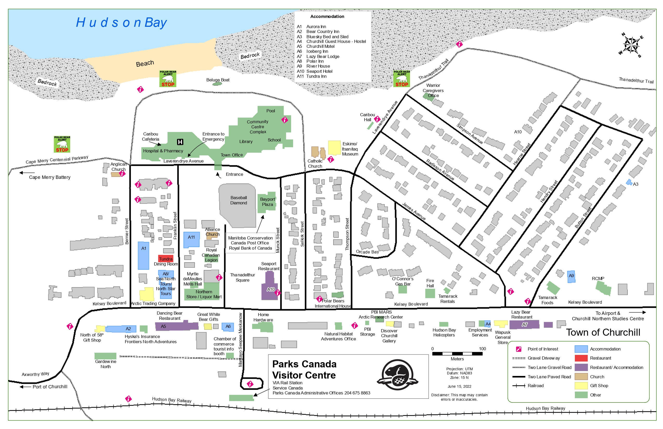
Image description
A map of Churchill, Manitoba, detailing all roads, driveways, and buildings in the town. A compass indicates North pointing at approximately a 45-degree angle to the upper left corner. The first column of the legend denotes pink diamonds with a white upward-facing arrow topped with a white dot as a point of interest, a series of thin parallel black lines as a gravel driveway, a thick grey line with a series of thin black lines down the centre as two-lane gravel roads, thick black lines as two-lane paved roads and thick black lines with perpendicular black lines as a railroad. The second column of the legend denotes light blue buildings as accommodation, red as restaurant, purple as both accommodation and restaurant, light brown as church, yellow as gift shop and green as other. At the bottom of the map, the Parks Canada Visitor Centre is identified above the Hudson Bay Railway and below the loop at the end of Mantayo Seepee Meskanow. At the top left and top right of the map, bedrock is identified in grey with beige in between those sections identifying beach. Near each of these three sections, a green square with black text saying “POLAR BEAR ALERT”, a white polar bear and red text saying “STOP” is present. The map is current to June 15, 2022.