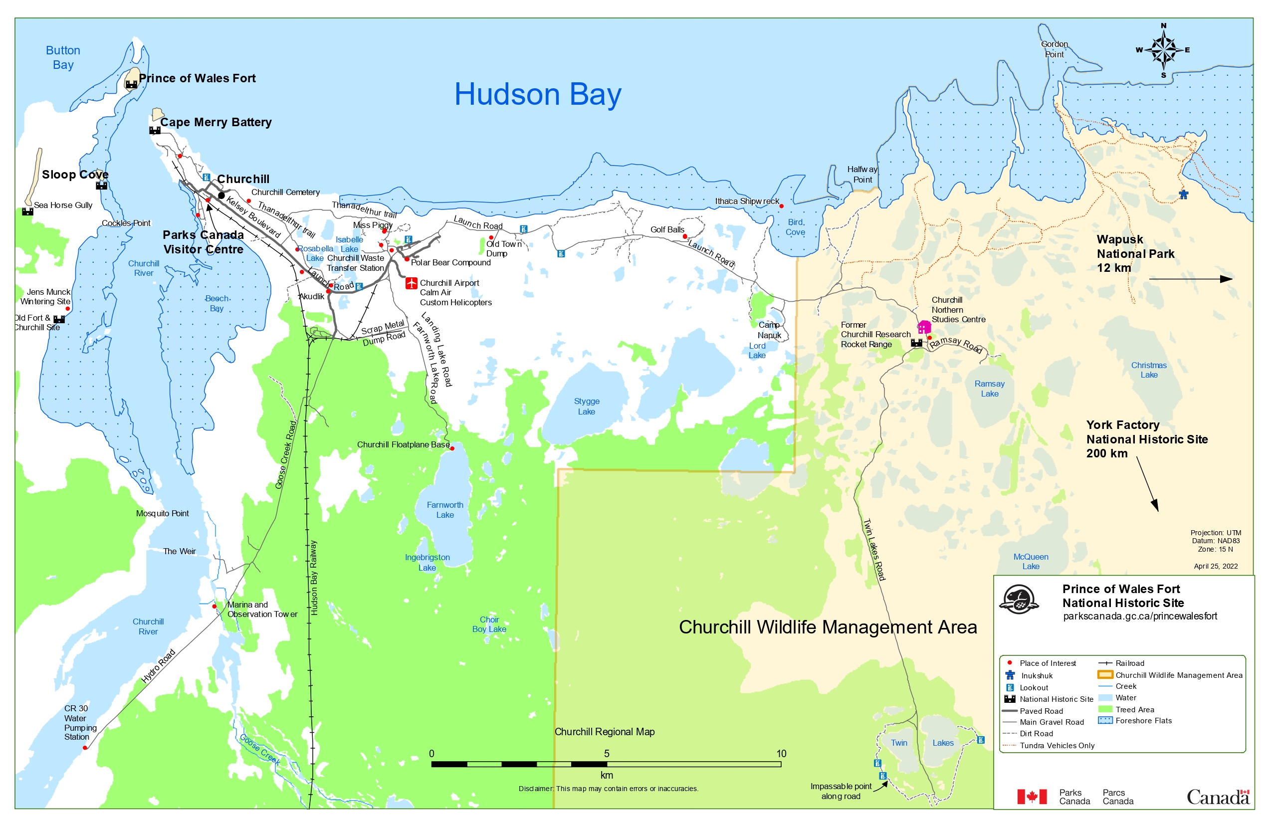
Image description
A map of Churchill, Manitoba and the surrounding area. Prince of Wales Fort is in the top left, with Cape Merry Battery to the southeast, separated by the Churchill River. The town of Churchill is located to the southeast, and the Churchill Wildlife Management Area is located to the east. The first column of the legend has a red dot denoting a place of interest, a thick blue shape with a rounded head and thick rectangular arms and legs denoting an inukshuk, a blue square with the outline of two people holding telescopes denoting a lookout, a black castle with two turrets denoting a national historic site, a thick grey line denoting a grey road, a thin black line denoting a main gravel road, a series of black lines denoting a dirt road, and a series of red lines denoting a road for tundra vehicles only. The second column of the legend denotes a long black line crossed with short black lines as a railroad, a thick orange borderline as the Churchill Wildlife Management Area, a thin blue line as a creek, blue area as water, green area as treed areas, and blue areas with a thick blue border and blue dots inside as foreshore flats.
The map indicates Wapusk National Park as being 12 kilometres east of the map and York Factory National Historic Site as being 200 kilometres southeast of the map.