Park Management

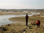
© Parks Canada / Wayne Lynch
to protect for all time a representative natural area of Canadian significance in the Western Arctic Lowlands natural region, and to encourage public understanding, appreciation and enjoyment of the area so as to leave it unimpaired for future generations while permitting subsistence usage and trapping by the Inuvialuit.
The park shall be operated and managed to protect the natural character of the park and the park's wildlife populations and their habitat, pursuant to the terms of The National Parks Act .
Specific park management objectives for Aulavik National Park are to:
- protect the integrity of ecosystems and cultural resources of the park by participating respectively with: the co-management process with the Inuvialuit Game Council (IGC) and co-management bodies, and the relevant Inuvialuit organizations under the Inuvialuit Regional Corporation (IRC);
- develop an understanding of the ecosystems within the park in support of the park's long term protection purpose;
- ensure that the integrity of the natural and cultural resources is not degraded over time, by identifying conditions and by monitoring these conditions carefully;
- ensure that the ties between the Inuvialuit and the land are maintained through subsistence usage;
- promote and encourage the education, training and development of Inuvialuit youth so that they may become equal participants in the ongoing management of the park;
- facilitate public appreciation, understanding, and enjoyment of the park through presentation and interpretation of natural and cultural heritage, and present day use of the park, including sustainable, traditional, cultural use;
- facilitate appropriate visitor use and tourism in the park, and to increase visitation and public awareness of the park;
- ensure that the majority of the economic benefits of the park accrue to the Sachs Harbour Inuvialuit; and
- ensure that ongoing traditional activities and subsistence usage are not affected by tourism.

Map of Aulavik National Park (PDF - 149 Kb)
Important Links
- The Western Arctic Claim - Inuvialuit Final Agreement
- An Agreement for the Establishment of a National Park on Banks Island
- Parks Canada Guide to Management Planning (2008) (PDF)
- 2010-11 Parks Canada Agency Corporate Plan
- Examples of other Parks Canada management plans
Contact Us
For more, please contact us at:
Aulavik National Park
Management Plan Update 2010 - 2011
Parks Canada
Western Arctic Field Unit
Box 1840
Inuvik, NT
X0E 0T0
Phone: 1.867.777.8800
Fax: 867-777-8820
Email: infoinuvik-inuvikinfo@pc.gc.ca


- Date modified :