Nááts’įhch’oh National Park Reserve Management Plan
Nááts'įhch'oh National Park Reserve
- Nááts’įhch’oh National Park Reserve Management Plan 2017 (PDF, 6.8 MB)
Table of contents
© Her Majesty the Queen in Right of Canada, represented by the Chief Executive Officer of Parks Canada, 2017.
Cette publication est aussi disponible en français.
National Library of Canada cataloguing in publication data:
- Parks Canada
- Nááts’įhch’oh National Park Reserve of Canada Management Plan 2017
Issued also in French under the title:
Réserve de parc national Nááts'įhch'oh du Canada : Plan directeur 2017
Available also on the Internet
- ISBN 978-0-660-09423-6
- Cat. no. R64-503/2017E-PDF
For more information about the management plan or about
P.O. Box 157
Tulita, NT X0E 0K0
Canada
Front Cover Image Credits
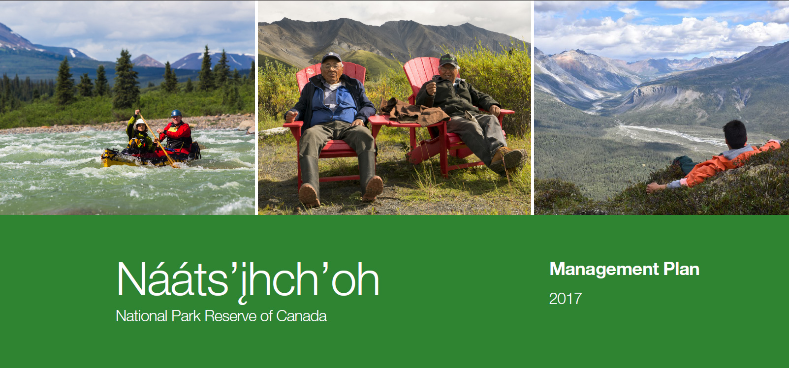
top from left to right: Tehjeh Deé © NWWT/Colin Field, 2016; Elders in Red Chairs © Parks Canada/Eric Laflamme, 2016; Mountaintop Views © Parks Canada/Jeff Stewart, 2017.
bottom: Sadéé Shúh © Craig Kerr, 2016.
Foreword

Canada’s national parks, national historic sites and national marine conservation areas belong to all Canadians and offer truly Canadian experiences.
These special places make up one of the finest and most extensive systems of protected natural and cultural heritage areas in the world.
The Government is committed to preserving our natural and cultural heritage, expanding the system of protected places and contributing to the recovery of species-at-risk. At the same time, we must continue to offer new and innovative visitor and outreach programs and activities so that more Canadians can experience Parks Canada places and learn about our environment, history and culture.
This management plan for Nááts’įhch’oh National Park Reserve of Canada supports this vision.
Management plans are developed through extensive consultation and input from various people and organizations, including Indigenous peoples, local and regional residents, visitors and the dedicated team at Parks Canada.
National parks, national historic sites and national marine conservation areas are a priority for the Government of Canada. I would like to thank everyone who contributed to this plan for their commitment and spirit of co-operation.
As the Minister responsible for Parks Canada, I applaud this collaborative effort and I am pleased to approve the Nááts’įhch’oh National Park Reserve of Canada Management Plan.
Original signed by
Approval
Approved and original signed by
Michael Neyelle
Chair
Ɂehdzo Got’ı̨nę Gots’ę́ Nákedı
Sahtu Renewable Resources Board
Recommendations
Recommended and original signed by
Daniel Watson
Chief Executive Officer
Parks Canada
Jonah Mitchell
Field Unit Superintendent
Southwest Northwest Territories Field Unit
Parks Canada
Executive Summary
Located in the southwestern portion of the Sahtu Settlement Area, Nááts’įhch’oh National Park Reserve of Canada is 4,895 km2 in size, it is part of the homeland of the Shúhtaot’ine (Mountain Dene). An Impact and Benefit Plan was signed in 2012 with the Sahtu Dene and Metis of the Tulita District. The Park Management Committee helps guide Park operations. The Committee was instrumental in the development of this, the first management plan for Nááts’įhch’oh National Park Reserve of Canada.
This management plan reflects the cooperative spirit of the Impact and Benefit Plan by weaving in the voices of the Sahtu people. Since the Park was announced in 2012, significant work has occurred, including a traditional knowledge study, increasing employment of local Sahtu Dene and Metis people, baseline ecological monitoring, as well as the development of new visitor products.
In this management plan, a vision is introduced for the Park to be a place where Sahtu Dene and Metis traditions continue, and Shúhtaot’ine stories, knowledge, and protocols guide and teach people and the health of the land, wildlife and waters are protected. Three key strategies are proposed to guide Park management activities for the next 5 to 10 years and support the achievement of the vision.
Key Strategy 1
Dene and Metis Connection
This strategy recognizes the importance of the relationship to the land, water, wildlife and spiritually sacred spaces in the Park to the Sahtu Dene and Metis of the Tulita District, specifically the Shúhtaot’ine - the Mountain Dene. The Park aims to celebrate and recognize these connections, and forge new ones with visitors, Canadians and people from around the world.
Key strategy 2
Heartbeat of the Land
This strategy recognizes the need to ensure the health of the land for future generations – from wildlife, to water, to cultural resources. Monitoring and research programs will be implemented that draw from both traditional knowledge and science.
Key strategy 3
Building a Presence in the Tulita District
Parks Canada will be building its presence in the Tulita District through community relationships, employment, and infrastructure.
Nááts’įhch’oh, is a very strong name. It is sacred ground, a sacred mountain. People were given medicine power from the area; this is why we, the Shúhtaot’ine, have lived a long time. The mountain is powerful.
Wildlife is declining. Landscapes don’t look like they did in the past. Elders predicted this change; it is happening. We want to continue to live off the land.
A national park is a powerful tool for protection.
We, the Dene people and wildlife, need the land. Without the land there is nothing to talk about.
1.0 Introduction
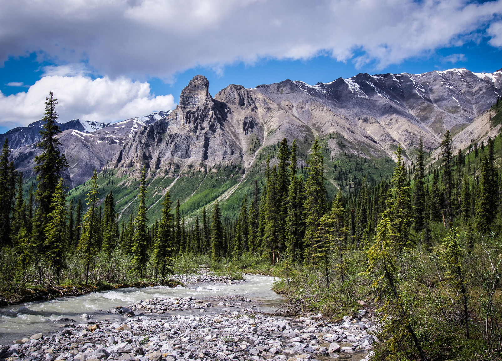
© Parks Canada/Christian Boucher, 2009
I come from the Mountain Dene, as a youth I know the land defines us as a people, it is entrusted in me to watch over it as I grow older.
The Creator led the Shúhtaot’ine (Mountain Dene) to make the mountains their home. There, they became the keepers of the land, water, wildlife and sacred places. This role continues today. Guided by the 2012 Nááts’įhch’oh National Park Reserve Impact and Benefit Plan (Impact and Benefit Plan), the Sahtu Dene and Metis of the Tulita District and Parks Canada co-operatively manage Nááts’įhch’oh National Park Reserve of Canada (the Park). We – the Park Management Committee and Parks Canada - envision a future where the Sahtu Dene and Metis continue as keepers of the land in the Park. Through their work as park employees and tour operators, the Shúhtaot’ine connection to the land, their stories, and their teachings will inspire visitors, Canadians, and people of the world.
This document starts with an introduction to the management plan and the Park, it then flows into the vision, key strategies and zoning. The Management Committee feels that it is important to set the stage by describing where we want to be, and how we are going to get there. Sections which provide the planning context follow. The management plan then closes with a strategic environmental assessment of the outlined actions.
1.1 Park Management Plan
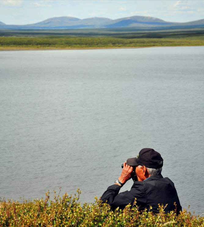
© Parks Canada/Laani Uunila, 2016
This plan is the first management plan for Nááts’įhch’oh National Park Reserve. The Canada National Parks Act and the Parks Canada Agency Act require Parks Canada to prepare a management plan for each national park. The Impact and Benefit Plan requires the first management plan to be completed in 2017. The Nááts’įhch’oh National Park Reserve Management Plan is approved by both the Sahtu Renewable Resources Board and the Minister responsible for Parks Canada, and is tabled in Parliament.
This management plan reflects the cooperative spirit of the Impact and Benefit Plan by weaving in the voices of the Sahtu people. Together, we will preserve, protect, and celebrate the Park lands, respect the mandate of Parks Canada, incorporate the advice of the Nááts’įhch’oh National Park Reserve Management Committee, and honour the knowledge and experience of and commitments to the Sahtu Dene and Metis people.
This plan sets a clear vision and strategic direction for the management and operation of Nááts’įhch’oh National Park Reserve. Parks Canada will report annually on progress toward achieving the plan and will review the plan every five to ten years, as per the requirements of the Impact and Benefit Plan and the Canada National Parks Act. Parks Canada and the Management Committee will maintain an open dialogue on the implementation of the management plan, to ensure that it remains relevant and meaningful.
2.0 Significance of Nááts’įhch’oh National Park Reserve

© Parks Canada/John McKinnon, 2013
Everything is important: special hot springs…all the forest, berries, grass, plants, […the] watershed. It is all important to our life.
Many dedicated people from the Sahtu Dene and Metis, as well as, from the federal and territorial governments helped create the Park. After years of discussion, the Impact and Benefit Plan was signed in March 2012, shortly followed by the announcement of the creation of Nááts’įhch’oh National Park Reserve in August 2012. The Park was formally established under the Canada National Parks Act in December 2014.
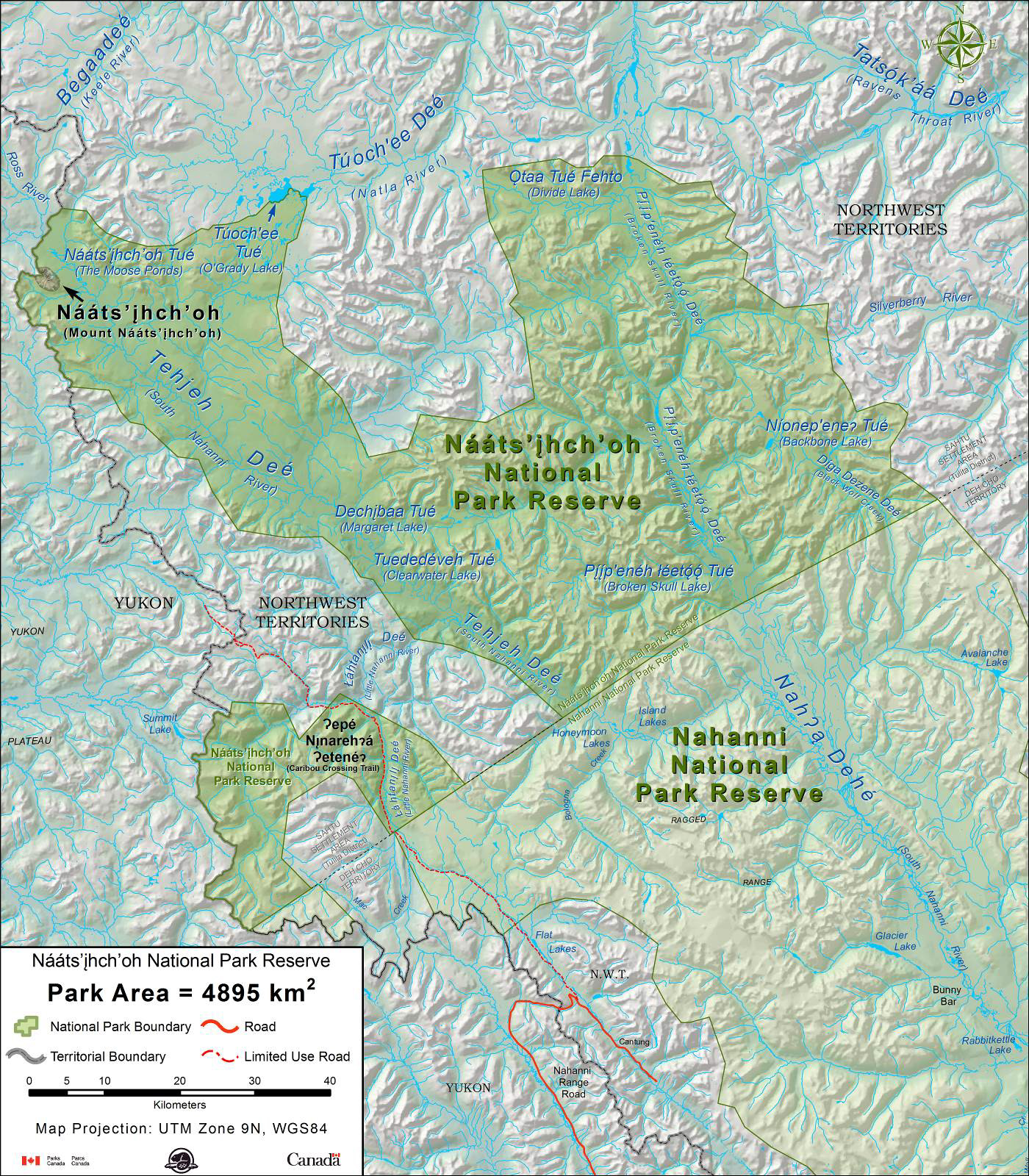
Located in the southwestern portion of the Sahtu Settlement Area, Nááts’įhch’oh National Park Reserve is 4,895 km2 in size. The Park protects the lands around Mount Nááts’įhch’oh and is important habitat for grizzly bear, Dall’s sheep, mountain goats, woodland caribou, and trumpeter swans. Together with Nahanni National Park Reserve, the Park protects 86% of the Tehjeh Deé (South Nahanni River) watershed. It is a place where wildlife can thrive and traditional harvesting can continue for future generations.
The Shúhtaot’ine have travelled this area and value it for its hunting and cultural importance. The mountain from which the Park takes its name is credited with great spiritual powers. Power, energy, and medicine sites can be found throughout the Park.
The Park is also an important area for the Kaska Dena and Dehcho First Nations. Along with Sahtu Dene and Metis, Kaska Dena continue to harvest on lands within the Park.
2.1 Regional Setting

[…] from Tulita the Raven’s Throat trail, Keele River trail, Canol trail - our Mountain Dene trails eventually lead into Nááts’įhch’oh.
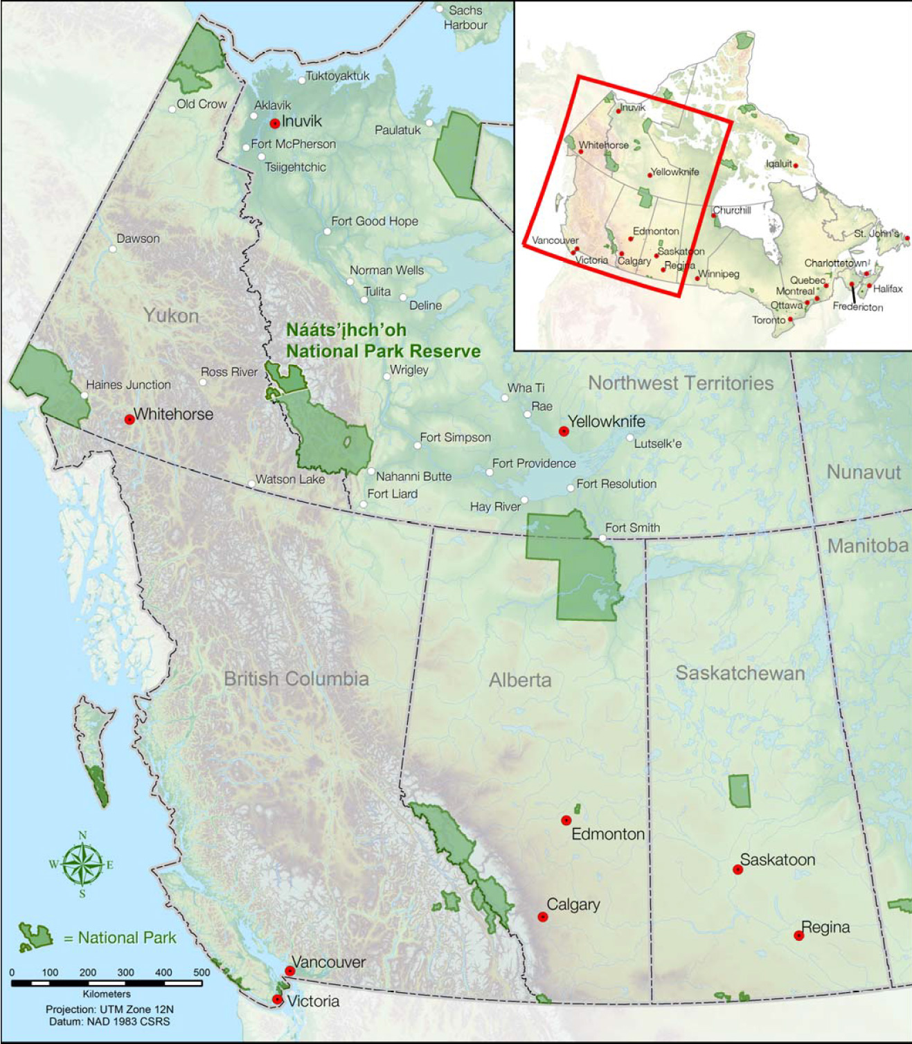
Nááts’įhch’oh National Park Reserve is located in the Tulita District of the Sahtu Settlement Area of the Northwest Territories. The Tulita District includes two communities, Tulita and Norman Wells, and three land corporations: Tulita Land Corporation, Fort Norman Metis Land Corporation and Norman Wells Land Corporation.
The Park boundaries extend to the Yukon border in the west and Nahanni National Park Reserve to the south. Waters in the Park flow into two watersheds – Begaadeé (Keele River) and Tehjeh Deé (South Nahanni River). From Túoch'ee Tué (O’Grady Lake) the waters flow into Túochee Deé (Natla River) into Begaadeé. All other waters in the Park flow into Tehjeh Deé, and onwards into Dehcho territory and Nahanni National Park Reserve.
Map 1: Regional Setting – Nááts’įhch’oh National Park Reserve
Map 2: Nááts’įhch’oh National Park Reserve
3.0 Vision
It’s almost like the mountains have kept the music…you can feel the spirit of our ancestors and you can feel the powerful feeling from the mountains. It’s so majestic. It’s so overwhelming.Footnote 1
The vision for Nááts’įhch’oh National Park Reserve was developed through workshops, community open houses and from the words of people who have travelled the land and waters. Its intention is to capture the sense of place and paint a picture of the future where the Sahtu Dene and Metis are an integral part of the operations and visitor experiences in the Park.
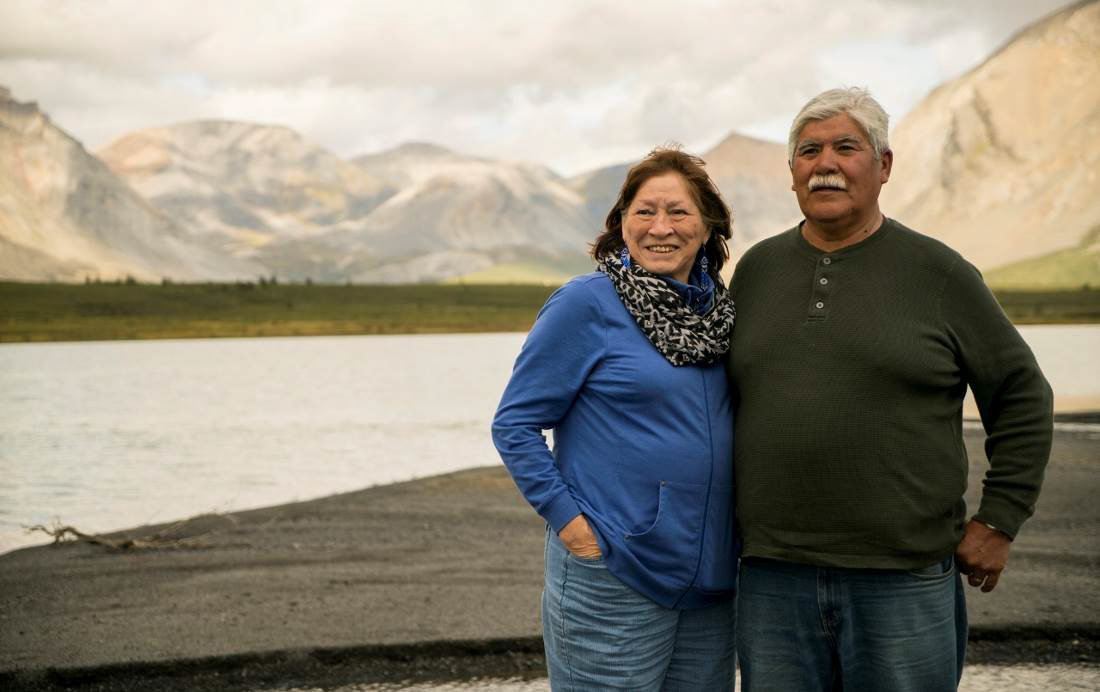
© Parks Canada/Eric LaFlamme, 2016.
Welcome to the ancestral homeland of the Shúhtaot’ine, the Mountain Dene and Metis. The Park is a place where culture and nature are intertwined. It is a place where traditions continue. The Sahtu Dene and Metis of the Tulita District and Parks Canada are entrusted to care for the land, water, wildlife, spiritually sacred places and cultural artifacts found in the Park. If we take care of the land, the land will take care of us. Shúhtaot’ine stories, knowledge, and protocols guide and teach people.
Where Tehjeh Deé (the South Nahanni River) and its tributaries stretch high into the Mackenzie Mountains, the Park protects them. Here, nature shapes the land. Whether it is caribou on their calving grounds, the dense population of grizzly bears, or the northernmost population of mountain goats - plants and animals thrive here.
Flying into the Park, you get a bird’s eye view of your upcoming journey. As the days lengthen, melting snow trickles down slopes into the sparkling rivers below. River valleys burst green against the grey, red, and orange mountains. On the ground, and with the plane gone, the sounds of the land – a creek flowing into a lake, birds flitting around - bring a calmness and peace. Time seems to stand still as you feel the cool waters on your feet. Pausing for a moment, you watch a moose browse on the far shore. Walk for days in any direction through long mountain views. Paddle the wild headwaters of Tehjeh Deé, or, let local guides tune your ears to the music that these mountains keep.
4.0 Key Strategies

4.1 Dene and Metis Connection
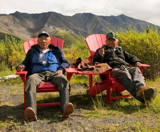
© Parks Canada/Eric LaFlamme, 2016.
The relationship to the land, water, wildlife and spiritually sacred spaces within Nááts’įhch’oh National Park Reserve is of upmost importance to the Sahtu Dene and Metis of the Tulita District, specifically the Shúhtaot’ine - the Mountain Dene – as this is their homeland. This bond comes from their Sahtu ancestors and endures through the youth. The Park will celebrate and recognize these connections, and forge new ones with visitors, both Canadians and people from around the world.
There are so many things that the land gives, but what I like most about our land is that we are able to get our food off it, our medicine off it, and just our peace and quietness. You want to go on the land to just relax and enjoy.
Objective 1:
Support and encourage use and access by the Sahtu Dene and Metis of the Tulita District.
Targets:
- Provide opportunities for Tulita District Land Corporation members to maintain a cultural and spiritual connection with the Park, in part through volunteer opportunities.
- Support and work with the proponents of an eco-tourism facility, should a proposal be brought forward by the Tulita District Land Corporation, as per the Impact and Benefit Plan.
- Produce at least one communications product to clearly convey the existence and purpose of the Park and to encourage Park use by the Sahtu Dene and Metis people of the Tulita District.
Objective 2:
Support tourism initiatives by Tulita District Land Corporation members, as per the Impact and Benefit Plan.
Targets:
- Provide advice on business licence applications to Tulita District beneficiaries looking to operate in the Park.
- Open Parks Canada training opportunities to Tulita District beneficiaries interested in tourism ventures or employment with Parks Canada.
It is up to us to take the opportunities.
Objective 3:
Collaboratively develop programming that shares Shúhtaot’ine culture with visitors, Canadians and international audiences.
Targets:
- Incorporate traditional place names into Park programming and products.
- Continue urban outreach initiatives in priority cities such as Yellowknife, Vancouver and Calgary.
- Connect with Canadians and other audiences by telling stories from Nááts’ihch’oh through media pitches, social media and web content.
- Pursue opportunities to promote tourism through non-government agencies and organizations with a mandate and interest in conservation, tourism, outdoor education, culture and nature.
- Develop a volunteer program as part of the Park’s research and visitor experience programs.
- Offer two new visitor opportunities by 2021.
- Develop and implement products (e.g., publications, enhanced web presence and multi-media) and initiatives for Canadian, international, and urban audiences.
- Cooperatively develop cultural programming and products.
- Infuse the stories and perspectives of the Shúhtaot’ine into all visitor programs.
4.2 Heartbeat of the Land

We need to ensure the health of the land for future generations – from wildlife, to water, to cultural resources. To accomplish this, we will develop and implement monitoring and research programs that integrate traditional knowledge and science.
Well the land is like our mother: it takes care of us, if we let it take care of us…We should respect the land wherever we are travelling, pay respect to get us through. And the land is…where our grandfathers, our forefathers… and our grandmas… [are] all buried. I think that’s why it takes care of us, and we should respect the land.
Objective 1:
Take care of the land and waters, and regularly measure the health of the Park.
Targets:
- Implement the health of the Park monitoring program, known as the Ecological Integrity Monitoring Program, to measure changes in the ecosystemFootnote 2. A draft of the Program’s indicators and measures will be available for review in 2018.
- Install a weather monitoring station to determine normal weather patterns and help with the understanding of climate change, fire, and other ecosystem processes.
- Provide input into activities adjacent to the Park that may impact the Park (e.g. Sahtu Land Use Plan zoning adjacent to the Park, Species at Risk planning and other species specific stewardship initiatives).
- Ensure visitor experience programs, monitoring and operations are connected with those in Nahanni.
- Determine if there is interest from Yukon Government and Kaska Dena in protecting the portion of Mount Nááts’įhch’oh (Mount Wilson) in Yukon.
Objective 2:
Ensure cultural values and traditional knowledge shape Park operations.
Respect our oral history, traditional knowledge and our culture.
Targets:
- Facilitate the sharing of cultural and scientific research with communities through a community event (e.g. public meeting) in Tulita and Norman Wells, and through other means (e.g. radio, newsletter).
- Provide opportunities for visitors to learn about the importance of key wildlife species, traditional harvesting and cultural protocols.
- Collaborate with the Management Committee on the documentation, protection, and presentation of cultural resources and traditional knowledge.
- Offer training in Sahtu Dene and Metis protocols and culture to Park staff.
- Develop mechanisms to support community culture camps and on-the-land programs for local youth.
Involve the people.
4.3 Building a Presence in the Tulita District
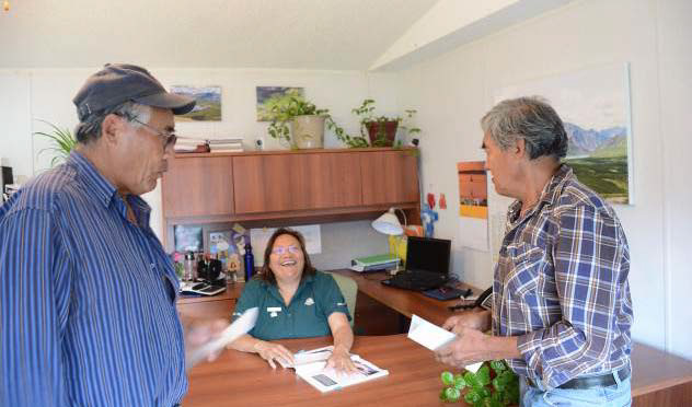
© Parks Canada/Eric LaFlamme, 2016.
Parks Canada will be building its presence in the Tulita District through community relationships, employment, and infrastructure. The Impact and Benefit Plan outlines commitments for a Park office, visitor centre, warehouse and housing in Tulita. Additionally, the Impact and Benefit Plan outlines trainee positions for the Superintendent and the Resource Conservation Supervisor, seasonal staff and two student positions.
Parks Canada in the community is a very big thing for Tulita.
Objective 1:
Develop programming to build capacity and an interest in Parks Canada jobs to support the preferential hiring program outlined in the Impact and Benefit Plan.
Targets:
- Work with partners in the communities to increase understanding of Parks Canada and the employment opportunities available.
- Facilitate at least one community training opportunity per year.
- Give consideration in all hiring processes, in addition to core competencies, to someone who knows the Tulita District lands, culture, communities, language, Comprehensive Land Claim, Park Impact and Benefit Plan and has relevant experience in Northern Canada as per the Impact and Benefit Plan.
- Support and mentor the Tulita District Sahtu Dene and Metis trainees so they can successfully compete on supervisor and management positions.
- Ensure flexibility in the organizational chart positions to support development and to ensure positions are a good fit for Norman Wells Land Corporation, Tulita Land Corporation and Fort Norman Metis Land Corporation members.
Objective 2:
Further develop the relationship between Parks Canada and the communities of Norman Wells and Tulita.
Targets:
- Participate in key community events in Norman Wells and Tulita.
- Communicate employment and general training opportunities with the communities, using available mechanisms (e.g. Land Corporation offices, community Facebook pages, local radio, career fairs, etc.).
Objective 3:
Develop a physical presence in Tulita by building an office, visitor centre, warehouse and housing, as per the Impact and Benefit Plan.
Targets:
- Develop a welcoming visitor centre in Tulita as part of the new office complex.
- Build staff accommodation; buy and rent housing as required.
Objective 4:
Assess current infrastructure and the need for future infrastructure in the Park.
Targets:
- Assess the Ǫtaa Tué Fehto (Divide Lake) cabin and associated outbuildings by 2020.
- Complete an initial assessment of park-wide infrastructure needs by 2021.
5.0 Zoning and Aircraft Access
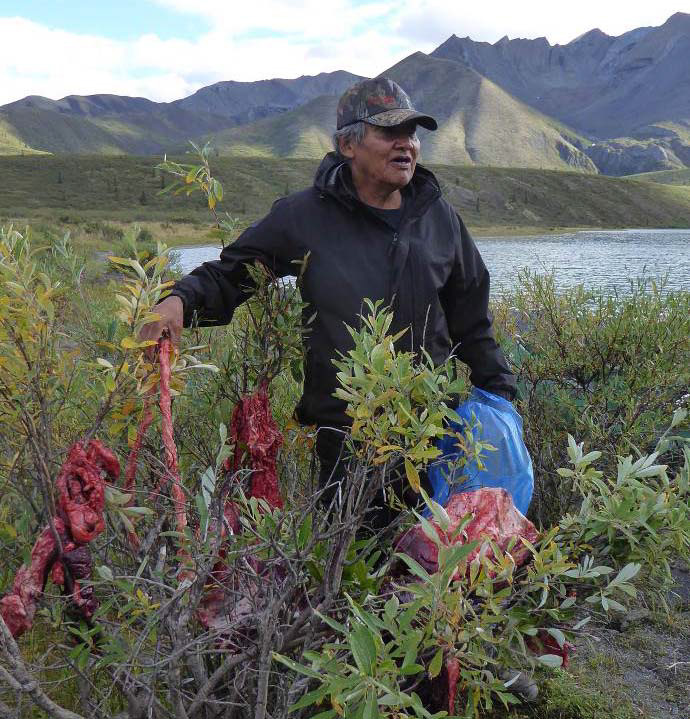
© Parks Canada/Lyn Elliott, 2016.
The land is so important, it needs protection.
Parks Canada’s zoning system defines how areas of a park can be used based on the ecosystem and cultural resource protection needs. The system has five types of zones (see sidebar):
- Zone I - Special Preservation;
- Zone II - Wilderness;
- Zone III - Natural Environment;
- Zone IV - Outdoor Recreation; and
- Zone V - Park Services.
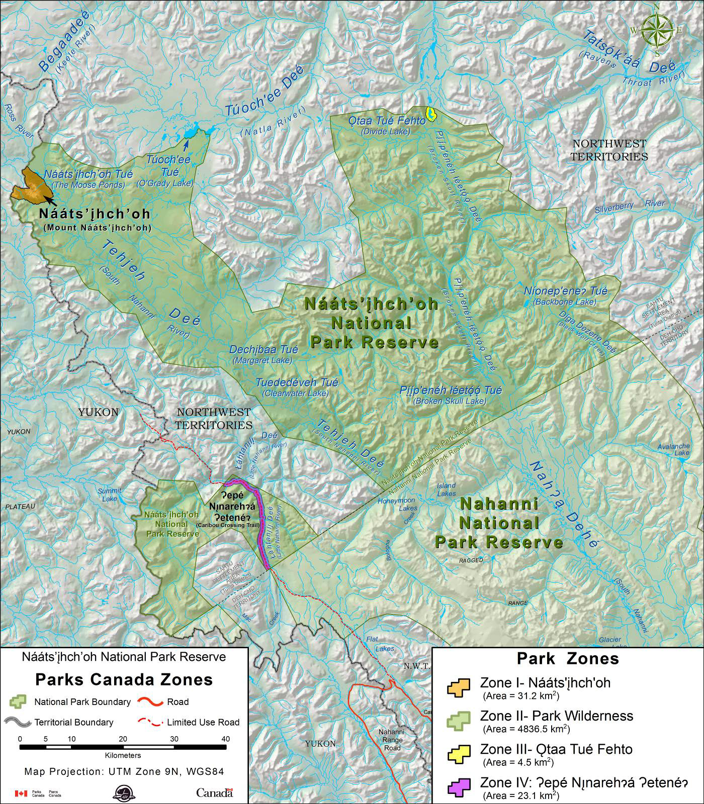
This management plan establishes the zoning for Nááts’įhch’oh National Park Reserve: one Special Preservation Zone, one Wilderness Zone, one Natural Environment Zone and one Outdoor Recreation Zone. As further knowledge is gained, additional zoning may be considered or the current zoning may be amended or refined.
The Park is principally a fly-in destination; therefore, controlled aircraft access will be permitted in all zones, except Zone I.
Access by Aboriginal traditional users and traditional harvesting activities are not restricted by the Park’s zoning.
Parks Canada’s Five Zones
Zone I - Special Preservation:
Small areas within a national park that require special preservation because they contain unique, threatened or endangered natural or cultural features. Preservation is the key consideration. Motorized access is not permitted. Where an area is too fragile to allow public access, every effort will be made to provide park visitors with off-site programs and exhibits interpreting the area’s special characteristics.
Zone II – Wilderness:
Extensive areas that are good representations of a natural region and are conserved in a wilderness state. The perpetuation of ecosystems with minimal human interference is the key consideration. Zone II areas offer opportunities for visitors to experience first¬hand the park’s ecosystems and require few, if any, services and facilities. In much of Zone II, visitors have the opportunity to experience remoteness and solitude. Motorized access is not permitted except for controlled air access.
Zone III – Natural Environment:
Areas which are managed as natural environments, which provide opportunities for visitors to experience a park’s natural and cultural heritage values through outdoor recreation activities requiring minimal services or facilities of a rustic nature. While motorized access may be allowed, it will be controlled.
Zone IV – Outdoor Recreation:
Limited areas which are capable of accommodating a broad range of opportunities for understanding, appreciation and enjoyment of the park’s heritage values and related essential services and facilities, in ways that impact the ecological integrity of the park to the smallest extent possible, and whose defining feature is direct access by motorized vehicles. Park management plans may limit private motorized access and circulation.
Zone V – Park Services:
Communities in existing national parks which contain a concentration of visitor services and support facilities (e.g. Jasper, Banff).
5.1 Zone I – Mount Nááts’įhch’oh

© NWTT/Colin Field, 2016
Mount Nááts’įhch’oh is the only Zone I – Special Preservation area in the Park; it is also considered a culturally sensitive area. Due to its spiritual power and cultural significance, Elders have requested that access to the mountain be prohibited. This restriction does not apply to Dene or Metis people, nor to access for operational purposes by Parks Canada staff.
The Zone I area does not encompass Nááts’įhch’oh Tué (The Moose Ponds), a lake, which lies below the slopes of the mountain.
5.2 Zone II – Park Wilderness

The majority of the Park is zoned Wilderness, with the exception of the Mount Nááts’įhch’oh (Zone I), Ǫtaa Tué Fehto - Divide Lake (Zone III) and Ɂepé Nı̨narehɂá Ɂetenéɂ (Caribou Crossing Trail / Howard’s Pass Access Road) (Zone IV). Designation of wilderness through the National Parks of Canada Wilderness Area Declaration Regulations will not be pursued at this time.
5.3 Zone III – Ǫtaa Tué Fehto (Divide Lake)

Otaa Tué Fehto (Divide Lake) is Zone III - Natural Environment. When the Park was created, Parks Canada inherited a hunting outfitter’s camp – this cabin and its outbuildings are located at the lake. It is envisioned that an on-the-land camp and the eco-tourism facility, noted in the Impact and Benefit Plan, may possibly be developed at this location, meaning there may be a future need for additional facilities. Trips down Pı̨́ı̨́p'enéh łéetǫ́ǫ́ Deé (Broken Skull River) start at this location.
5.4 Zone IV – Ɂepé Nı̨narehɂá Ɂetenéɂ (Caribou Crossing Trail / Howard’s Pass Access Road)
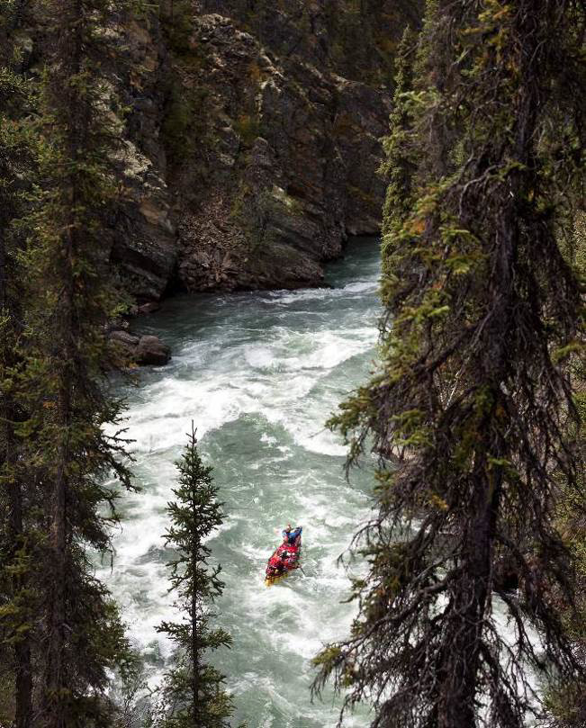
Ɂepé Nı̨narehɂá Ɂetenéɂ (Caribou Crossing Trail / Howard’s Pass Access Road) is Zone IV. This zone was selected because the defining feature is direct access by motorized vehicle. A licence of occupationFootnote 3 that pre-dates the Park is held by Selwyn Chihong Mining Ltd. for the road. There is industrial traffic on this road.
The road parallels Łáhtanı̨lı̨ Deé (Little Nahanni River) for a portion of its length. The river is an important recreational corridor for visitors – the river is part of the Zone II Wilderness area. The river valley and surrounding area are important for species of special concern, such as the federally listed northern mountain caribou, as it includes a portion of the South Nahanni herd’s calving, summer and rut ranges. It is also an area of high grizzly bear density.
Limitations to private motorized access
A restricted activity permit is required for anyone using Ɂepé Nı̨narehɂá Ɂetenéɂ (Caribou Crossing Trail / Howard’s Pass Access Road) within Nááts’įhch’oh or Nahanni National Park Reserves, with the exception of Aboriginal traditional users. There are safety considerations for travel on the road, visitors are requested to contact the Nááts’ihch’oh or Nahanni office for further information.
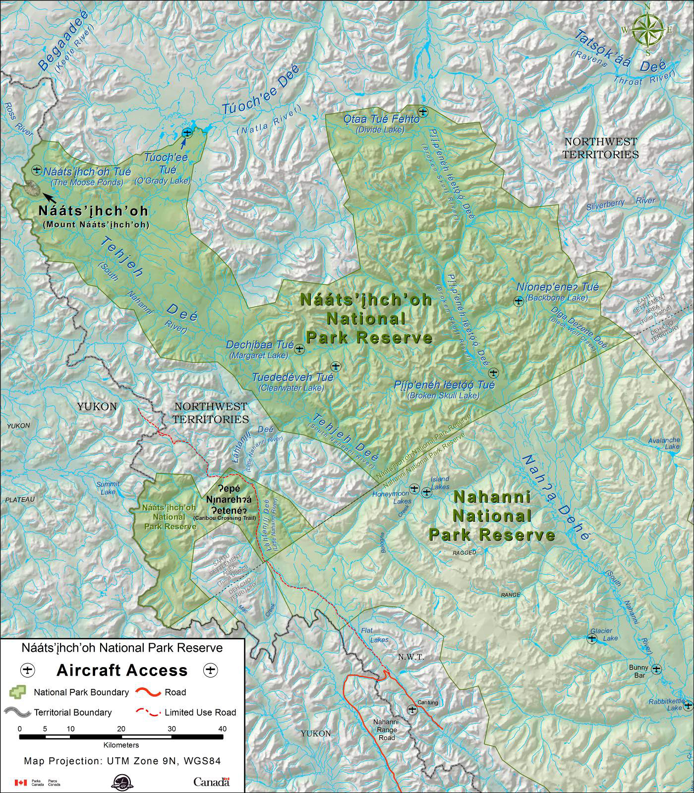
Map 3: Nááts’įhch’oh National Park Reserve Zoning
5.5 Aircraft Access

In the Park aircraft access is permitted in Zones II, III and IV with an Aircraft Access Permit. All permits are subject to the National Parks of Canada Aircraft Access Regulations.
There are no landing strips in the Park, all fixed wing aircraft require floats or skis. The Park will consider pursuing designated aircraft take-off and landing sites at the following lakes once archaeological assessments are completed:
- Nááts’įhch’oh Tué (The Moose Ponds) 62.918522°, -129.682385°
- Túoch'ee Tué (O’Grady Lake) 62.98627°, -129.09764°
- Ǫtaa Tué Fehto (Divide Lake) 63.02135°, -128.17990°
- Níonep’eneʔ Tué (Backbone Lake, formerly Grizzly Bear Lake) 62.68314°, -127.82007°
- Pı̨́ı̨́p'enéh łéetǫ́ǫ́ Tué (Broken Skull Lake) 62.557214°, -127.921782°
- Dechįbaa Tué (Margaret Lake) 62.603404°, -128.665553°
- Tuededéveh Tué (Clearwater Lake) 62.57250°, -128.52633°
All these lakes have been used as access points prior to the establishment of the Park.

Map 4: Proposed Designated Landing Sites
6.0 Planning Context
[Mount] Nááts’įhch’oh has been known for its spiritual power for generations. Being a national park reserve will help protect Nááts’įhch’oh.
6.1 Parks Canada
Parks Canada was born out of a dream…to create an organisation that would help protect, for generations to come, the rich heritage of the many people who inhabit this land. It was created to help protect the natural beauty of this country, our most precious gems, to be enjoyed for generations to come in ways that leave them unimpaired.
Parks Canada, the oldest national park management organization in the world, is responsible for administering a system of national parks, historic sites and marine conservation areas. These protected heritage areas showcase our country’s natural, cultural and historic treasures. Parks Canada’s vision is: Canada’s treasured natural and historic places will be a living legacy, connecting hearts and minds to a stronger, deeper understanding of the very essence of Canada.
National parks are established to protect and present outstanding and representative examples of natural regions. Parks Canada is responsible for both protecting the ecosystems of these natural areas and facilitating experiences – enabling Canadians to discover and build connections with these places.
6.2 Purposes of the Park
The Park land should be considered as an important land to all.
The purposes of the Park, as identified in the Impact Benefit Plan, are:
- preserve and protect for future generations a representative example of the Mackenzie Mountains natural region of Canada and provide for conservation in the Park;
- sustain the ecological integrity of Tuchįtł’á (Tehjeh Deé / South Nahanni River watershed and lands);
- encourage public understanding, appreciation and enjoyment of the Park;
- enhance the experience of visitors to the Park;
- acknowledge Sahtu Dene and Metis rights to use the Park for harvesting wildlife, and, in the exercise of wildlife harvesting rights, plants and trees in the Park;
- create employment and business opportunities for membersFootnote 4 and members’ businesses;
- encourage the use of Dene KedeéFootnote 5 in connection with the Park and its infrastructure; and
- acknowledge the ability of the Sahtu Dene and Metis to use heritage resources in the Park for spiritual, cultural, religious and educational activities.
6.3 Nááts’įhch’oh National Park Reserve Management Committee

We have more in common than what divides us. We can build something unique and different.
The Nááts’įhch’oh National Park Reserve of Canada Impact and Benefit Plan defines the cooperative management of the Park and sets the foundation for the Nááts’įhch’oh National Park Reserve Management Committee.
The role of the Committee is to advise the Minister responsible for Parks Canada or the Minister’s designate, the Sahtu Renewable Resources Board, and other agencies of Government as appropriate, on the following matters:
- all matters affecting the Park which lie within the Sahtu Renewable Resources Board's powers and responsibilities;
- the Management Plan and any amendments to it;
- Park employment, training plans and economic opportunities for members associated with the development and operation of the Park;
- qualifications of and the number of interpreters and guides that should be authorized to operate in the Park;
- any proposed changes to the Park boundaries;
- issuance of permits for cabins or camps which may be required for the exercise of the harvesting rights of the ParticipantsFootnote 6;
- measures to give protection to sites of cultural and spiritual significance to the Sahtu people, and of archaeological significance within the Park;
- information and interpretive programs to recognize local history, culture and traditional use of the Park;
- research and field work conducted by or for the government in the Park; and
- any other matters which may be referred to the Management Committee by the Minister, the Sahtu Renewable Resources Board or agencies of government.
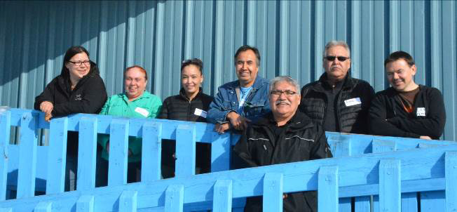
The Management Committee has eight members and an internally elected Chair. Two members are appointed by the Tulita Renewable Resources Council, one being a member of the Tulita Land Corporation and one a member of the Fort Norman Metis Land Corporation. The Norman Wells Renewable Resources Council appoints a member from the Norman Wells Land Corporation. As well, one member is jointly appointed by both Renewable Resource Councils. Four members are appointed by the Minister responsible for Parks Canada. Of these four, one member is selected in consultation with the Government of the Northwest Territories, and one is recommended by Dehcho First Nations.
6.4 Legal and Administrative Context
The Impact and Benefit Plan indicates the Park office is to be located in Tulita.
The Park is located in the Sahtu Settlement Area. However, Kaska Dena and the Dehcho First Nations have overlapping interests in the area. Until these claims are settled, the Park will remain a national park reserve.
6.5 Commitments and Key Issues

© Parks Canada/Eric LaFlamme, 2016.

© Parks Canada/Eric LaFlamme, 2016.

© NWTT/Colin Field, 2016.
This management plan addresses priorities from the Impact and Benefit Plan, recommendations of the Management Committee, and issues identified in the 2015 State of the Park Assessment. The three key management priorities are: fulfilling economic and employment commitments, expanding visitor opportunities, and recognizing Shúhtaot’ine culture. A fourth area of focus, is Ɂepé Nı̨narehɂá Ɂetenéɂ (Caribou Crossing Trail/Howard’s Pass Access Road), management of which is non-standard for Parks Canada. These commitments and issues are outlined in detail below, and are addressed in the key strategies and zoning outlined earlier in the plan.
Parks Canada is committed to working with our partners to continue progress in fulfilling the commitments in the Impact and Benefit Plan, including economic benefits for the Sahtu Dene and Metis of the Tulita District. Employment and local contracting opportunities from the Park provide benefits to Tulita District Land Corporation members. Several staff positions are designed for Tulita District Land Corporation members. The Impact and Benefit Plan also outlines how Parks Canada will support Tulita District Land Corporation member businesses, including a first right of refusal process. Additionally, Parks Canada will invest in a visitor centre/office complex and two staff housing units in Tulita. Given the fact that the Park is in a settled land claim area, businesses operating in the Park should provide as much benefit as possible to the Sahtu Dene and Metis of the Tulita District. To support this, the Park’s business licence process requires applicants to outline any benefits provided to the Tulita District.
The Park recognizes a need to explore new visitor opportunities, as the full potential for visitor experiences remains untapped. Due to its remote location and the cost of access, few people visit. There were 61 visitors in 2015 and 115 visitors in 2016. Most visitors paddle one of three rivers: Tehjeh Deé (South Nahanni), Łáhtanı̨lı̨ Deé (Little Nahanni) or Pííp’enéh łéetóó Deé (Broken Skull). Other visitors use the Park to access Túochee Deé (Natla River) and Tátsǫ́k’áá Deé (Raven’s Throat River) or hike around Níonep’eneʔ Tué (Backbone Lake, formerly Grizzly Bear Lake).

Opportunities also exist for cultural tours, flightseeing tours, and hiking and backpacking trips. None of the current river outfitters sustain their businesses solely on Park visitors, and many operate throughout the Sahtu, the Northwest Territories, and beyond. There are few limits on the innovation and development of tourism projects; however, business operators cannot rely on Park visitors as their sole source of clients and/or income. Primarily a whitewater enthusiast’s Park, work will continue to promote river experiences, in addition to developing new opportunities.
Celebrating and honouring the cultural landscape of the Park is an important principle enshrined in the Impact and Benefit Plan. A knowledge gap has been identified in regards to cultural resources and Shúhtaot’ine place names. As more is learned about cultural resources and traditional knowledge, there is tremendous potential to inform protection, management, community sharing, communication products and the visitor offer. Working with our Sahtu partners, the Park can develop materials to share the human story of the Park with local youth and visitors.
The final management challenge facing the Park is Ɂepé Nı̨narehɂá Ɂetenéɂ (Caribou Crossing Trail / Howard’s Pass Access Road). Near the Yukon boundary, Ɂepé Nı̨narehɂá Ɂetenéɂ goes through both Nahanni and Nááts’įhch’oh National Park Reserves. The road is a pre-existing mining access road. Selwyn Chihong Mining Ltd. has a licence of occupation for this road. The road is located in a key area for caribou. The road also provides an increasingly popular access point for visitors paddling Łáhtanı̨lı̨ Deé (Little Nahanni River). Some major concerns include (but are not limited to) impacts to: ecological integrity, caribou, public safety and visitor experience.
7.0 Strategic Environmental Assessment
I can give you a good version of why it’s important to me…knowing that a lot of development has been happening within the Sahtu region particularly in Tulita area…we always hear from our people wanting to make sure that we always have our animals and certain areas that we can always go back to, to be able to hunt, fish, or trap. That’s why it’s important that we are able to leave a balance of some kind to our young people.
A strategic environmental assessment (SEA) was conducted for the Nááts'įhch'oh National Park Reserve Management Plan pursuant to the 2010 “Cabinet Directive on the Environmental Assessment of Policy, Plan and Program Proposals” (CEA Agency/Privy Council Office 2010). Its purpose was to identify and evaluate how proposed management strategies and actions might have any impact on the environmentFootnote 7 in the Park. The plan was developed through a partnership between Parks Canada and the Nááts’įhch’oh National Park Reserve Management Committee. Many Sahtu Dene and Metis community members also added their voices to the plan.
Targets of the plan were assessed to determine which have the greatest potential to interact positively and/or adversely with key environmental components and the scale, magnitude, and importance of the interactions was assessed. The majority of targets outlined in the plan were not expected to generate environmental effects of sufficient scale to warrant further assessment. The targets identified as having the potential to result in important positive and/or adverse interactions with key components include:
- The potential development of an eco-tourism facility in the Park;
- The development of two new visitor opportunities by 2021; and
- The installation of a weather monitoring station.
© Parks Canada/Laani Uunila 2016.
Environmental Impact Assessment (EIA) under the Mackenzie Valley Resource Management Act must be completed prior to commencement of these initiatives; this will include mitigation measures to address adverse effects in addition to identifying monitoring measures used to inform the Management Committee about the extent of effects. It is not expected that there will be cumulative effectsFootnote 8 resulting from implementation of the plan.
The direction outlined in the plan, combined with EIA prior to project commencement, will ensure that management plan implementation will not likely result in any significant adverse effects. For those initiatives that trigger the Mackenzie Valley Resource Management Act (MVRMA), the effects of proposed projects will be assessed prior to a decision being made to approve or not approve the project. In conclusion, implementation of the strategies in the Nááts'ihch'oh National Park Reserve Management Plan is expected to achieve the desired positive results for the environment at Nááts’įhch’oh National Park Reserve. The plan will contribute to the objectives of “Planning for a Sustainable Future: Federal Sustainable Development Strategy for Canada” (2010) by protecting nature.
8.0 Acknowledgements

The words of Elders, youth and other community members guide the management direction for Nááts’įhch’oh National Park Reserve. Many thanks to everyone who shared their voices through traditional knowledge studies, workshops, meetings and other contributions. Thanks also to the Nááts’įhch’oh National Park Reserve Management Committee members who were actively involved in drafting the management plan:
- Paul Andrew
- Rhea McDonald
- Angus Lennie
- Gordon Yakeleya
- Lisa McDonald
- George Tsetso
- Jess Fortner
- Lee Montgomery
- Cam Zimmer
- Date modified :