

Landscape-scale conservation at Parks Canada
Parks Canada's report on conservation from 2018 to 2023
Parks Canada and partners are collaborating across boundaries to conserve natural ecosystems and species, and improve ecological connectivity. This is landscape-scale conservation.
Conservation cannot take place without collaboration. Nature does not recognize human jurisdictions. Parks Canada is working with First Nations, Metis and Inuit, multiple levels of government, non-governmental organizations, academia, industry, landowners, and others, to strengthen a system of protected areas that connects habitats, restores species, and preserves ecological integrity.
86% 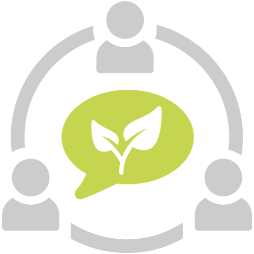
of projects in 2022 to 2023
collaborated with external partners
Featured projects
Ecological connectivity in La Mauricie National Park
Seeking to better connect nature and understand ecological corridors in La Mauricie.
Understanding carnivores, connectivity and co-existence
Identifying wildlife corridors and examining human-wildlife conflicts in the Beaver Hills Biosphere.
Mapping the Kespukwitk conservation corridor
Developing an interactive map of areas of importance in the Kespukwitk Conservation Corridor.
Video
Watch how Parks Canada works with diverse partners to connect wildlife habitats in many ways:
Transcript
[Photos of Cape Breton Highlands National Park, L’Anse aux Meadows National Historic Site, and Rouge National Urban Park flash across the screen.]
Recognize any of these places?
[People hiking and camping together.]
We often think of them as wild spaces for people to explore and enjoy, but they're also safe spaces for nature to thrive.
[A herd of caribou graze and lounge in the sun on top of a lightly snow-covered space. A bison and prairie dog stand together in an open grassland.]
[People walk along a pathway through a forest. An Orca surfaces and blows air through its spout.]
Protecting natural lands and waters like these is a key way to slow biodiversity loss and ease the effects of climate change.
[A bird sings while perched on a cattail that is swaying in the wind. A Polar Bear and its cub stand near the water.]
[A Parks Canada employee uses a tool to collect soil samples from the ground. Another employee stands nearby and records the data.]
We know that and we're trying to do more of it.
[Aerial view of Parks Canada employees completing field work. The camera quickly ascends, revealing a large grassy landscape surrounding the employees.]
In fact, Canada has already conserved over two million square kilometres of its land and marine areas and we're trying to increase that number as quickly as we can.
[A graph appears, revealing that the total amount of protected land and marine areas has greatly increased since 1990.]
[The graph reveals the planned increases to protected land and marine areas until 2030.]
This is good news.
[People walk their dog through a park. Two kayakers paddle along a rocky coast.]
But protecting more lands and more waters is just one piece of the puzzle.
[A turtle slowly crawls across greenery toward a water source. A moose moves through a forest during the winter.]
For protected places to be fully effective at conserving nature, we need to make sure species can safely access what they need to survive.
[An illustrated landscape appears. Plants and animals appear across the landscape. Protected areas appear on the landscape. Some species are located within the protected areas and some are located outside of the protected areas.]
And sometimes those things are beyond the boundaries of a protected area.
[A young bear runs across a road. The Parks Canada logo appears in the middle of the screen and fades away.]
So what can we do?
[Parks Canada employee, Liz Nelson, speaks into the camera.]
I think when I first started working at Parks, I really imagined borders to be this very obvious thing, like a fence…but species don't see that division.
[Name Tag] Dr. Elizabeth Nelson, Ecosystem Scientist, Parks Canada
This is Dr. Liz Nelson.
She's an expert in conservation planning at Parks Canada.
[An illustrated graphic appears with plant and animal species spread across the screen. Yellow arrows appear, indicating movement. Labels appear, indicating that animals travel to “mate”, “give birth”, “find food”, “disperse seeds”.]
Species on land, in the water and in the air travel to mate, give birth, find food, and disperse their seeds.
[Liz reappears on the screen and speaks into the camera.]
And species will move in and out of the park many times through their lifetime, often many times during the day.
[An illustration of two caribou appear. A label appears, indicating the caribou are standing in Gros Morne National Park.]
Take this example.
[Two caribou walk through a grassy landscape.]
Scientists at Natural Resources Canada tracked a herd of caribou around Gros Morne National Park for more than a year.
[An illustrated map appears. A dot begins moving across the screen, navigating between Gros Morne National Park and nearby Main River Waterway Provincial Park.]
You can see that the caribou spend plenty of time moving between Gros Morne and a nearby provincial park.
Allowing this sort of free flowing movement is exactly what we're trying to do.
[Liz speaks into the camera.]
Even when we plan protected areas to provide this safe haven for species and ecosystems we care about, we have to recognize that those species and ecosystems are always moving in and out of those spaces.
[A herd of caribou walk through a snowy landscape.]
[A Grizzly Bear and its cub walk across a road. Camera moves back to reveal a snowy mountain valley. An insect crawls along a plant. A fox crosses a road and pauses, looking into the camera.]
And we want to create space across larger landscapes to really give them the best chance of survival.
[A river flows through a forested fall landscape. Sheep run along a mountainside. A river flows through a green forest. An Eriophorum plant blows in the wind.]
The idea that connectivity is important isn't new, by the way.
Movement and connection have always been an integral part of Indigenous knowledge systems.
[A sheep stands on a rocky mountainside. A river flows through a human-made drainage system. A salmon swims near a river bottom. Two goats walk along a roadside. Two caribou rest in a snow-covered landscape.]
Aside from allowing access to basic necessities, unimpeded movement, inside and outside of protected areas, is critical for genetic exchange between populations.
[A bird walks along a beach. Two wolves run in a field. A beaver swims in a river. A sheep jumps over a roadside barrier.]
It also gives species space to move and adapt to changing climate conditions, which is only going to become more necessary.
When we block connections, we create problems for species and ecosystems.
[An illustrated landscape appears. Common barriers begin appearing on the map, including boats, a road, agricultural lands, and a large fence.]
Ocean traffic, dams, roadways, agricultural lands and fence ways are all examples of barriers that inhibit species movement and the flow of natural processes.
[A herd of caribou appear to stop at a barrier. A Bobcat hides in the shadows on the edge of a forest.]
[The illustrated landscape reappears. A large majority of the landscape fades away, leaving small fragments of protected areas. Lines begin to move within the protected areas, indicating that it’s difficult for species to move between protected areas.]
When we build these things, we're left with these small fragments of natural landscapes, isolating species who rely on movement to survive.
So really, what can we do?
[Pathways appear between the protected places, representing free movement.]
Our goal is to keep ecosystems connected, both within and outside of protected areas.
[Arctic birds fly over the ocean with an iceberg in the background. Cars drive fast on a highway. A highway underpass appears, illustrating one example of ways people can restore connections. Caribou run across a snowy landscape.]
We can't turn back time, but we can restore connections between habitats that have been lost and maintain the ones that remain.
[Examples of human-made structures that enhance connectivity for species appear on screen, including a highway underpass, a pathway underpass, and a curb ramp with a salamander climbing up.]
And those connections can come in all shapes and sizes.
[A photo of a highway overpass appears on screen. A wolf uses a highway underpass. A turtle uses a highway underpass.]
At Parks Canada, we're building highway overpasses and underpasses that help species across safely.
[An owl sits on the ground amongst greenery. An aerial view of Parks Canada employees standing next to a creek channel.]
We're restoring connections between protected areas and other habitat, by supporting ecological corridors.
[A backhoe clears debris from a creekbed. A flock of Greater Sage-grouse stands in a field. A barbed wire fence appears, representing a barrier.
We're removing human infrastructure that limits movements and natural flows,
[A member of the Haida Nation speaks to visitors in Gwaii Haanas. A group of snowmobilers cross a break in the ice of the northern coast of Baffin Island.]
We're learning from Indigenous knowledge holders how cultural
and ecological connections to the landscape are weaved together.
[Parks Canada employees remove debris from a creekbed. A small fish swims along the bottom of a creek.]
We're restoring creek channels and natural water flows for species at risk.
[Parks Canada employees and partners talk amongst one another.]
We're also working with universities, conservation groups, and other
governments to track species movements so we can prioritize new areas
[A Parks Canada employee inserts a memory card into their laptop to check a wildlife camera.]
to protect and confirm if existing connections are being used.
[Cattle graze in a large agricultural field. The illustrated landscape reappears with the connected protected places. Labels indicate examples of different individuals and organizations who manage protected areas, including “Marine Refuges”, “National”, “Provincial & Terrestrial Parks”, “National Wildlife Areas”, “Other Effective Area-Based Conservation Measures”, “National Marine Conservation Areas”, “Marine Protected Areas”, “Indigenous Protected & Conserved Areas”.]
The land that connects natural spaces is managed by all sorts of different individuals and organizations, meaning
no one group can tackle the challenge of connectivity alone.
[The labeled groups move into a circle. A web forms between them, indicating that the groups must work together.]
We need to think beyond boundaries and beyond borders: municipal,
provincial, federal, even continental.
[An aerial view of a river. Parks Canada employees and partners work together to move an inflatable watercraft through a mountain river.]
To protect nature, it needs to be connected, and we need to work together.
[A Parks Canada employee walks across a vast grassland.]
Find out more about how Parks Canada is connecting landscapes for conservation at the link on your screen.
- Date modified :