
Hiking
Gros Morne National Park
Gros Morne National Park protects some of the most spectacular scenery and wildlife in eastern Canada. There are more than 100 km of trails in the park, ranging from half-hour strolls to strenuous day hikes.
Trail Conditions
Find current trail conditions at Gros Morne National Park
Green Gardens Trail
A description of the Green Gardens hiking trail in Gros Morne National park.
Feeling adventurous?
Hikers that are interested in our backpacking trails can refer to our wilderness hiking page!
Trail conditions at Gros Morne National Park
Whether you’re out for a leisurely hike or a longer adventure, make your trip a safe one by checking the latest conditions.
Know before you go
Follow Parks Canada’s trail rating guide to select a trail that best suits your party’s abilities, experience, and interests, as well as the equipment and time you have available. Each trailhead has a map and orientation sign. Consult the park map for the locations of each hiking trail in the park.
Parks Canada developed trails are clearly marked throughout their length and have boardwalks, bridges, and stairs where necessary (with the exception of the gully up Gros Morne Mountain).
| Trail Rating | Suitability | Trail Surface | Terrain | Elevation Gain | Duration |
|---|---|---|---|---|---|
|
Easy
|
Most visitors including those with no trail experience. | Smooth hard packed trail surface. Minimal stairs. | Flat to gently rolling. | 0 to 100 meters. | Less than 2 hours. |
|
Moderate
|
Visitors with basic trail experience and who are generally prepared (proper clothing, footwear and water). | Generally smooth hard packed or firm and stable natural trail surface. Infrequent obstacles*, stairs may be present. | Gently rolling with short steep sections. | Up to 500 meters. |
Less than 5 hours. |
|
Difficult
|
For active hikers who have trail experience and are prepared (proper equipment, clothing, footwear and water). | Natural and uneven trail surface. Surface may be locally loose or unstable. Obstacles* common. | Rolling with many steep sections that may continue for long periods and exposure to steep terrain. |
May exceed 500 meters. |
May exceed 5 hours. |
Trails by region
North
| Trail | Length | Hiking Time | Rating |
|---|---|---|---|
| 1. Old Mail Road | 2 km return | 1 hour | easy |
| 2. Steve's Trail | 1 km return | 0.5 hour | easy |
| 3. Western Brook Pond | 6 km return | 1-2 hours | easy |
Central
| Trail | Length | Hiking Time | Rating |
|---|---|---|---|
| 4. Coastal Trail | 6 km return | 1-2 hours | easy |
| 5. Berry Head Pond | 2 km loop | 0.5-1 hour | easy |
| 6. Baker’s Brook Falls | 10 km return | 2-3 hours | moderate |
| 7. Berry Hill | 1.5 km return | 0.5-1 hour | moderate |
| 8. Berry Hill Pond | 2 km loop | 0.5-1 hour | easy |
| 9. Gros Morne Mountain | 17 km return | 6-8.5 hours | difficult |
| 9a. Gros Morne Approach | 9 km return | 2.5-3.5 hours | moderate |
| 9b. Gros Morne Summit Trail | 8 km loop | 3.5-5 hours | difficult |
| 10. Mattie Mitchell | 250 m loop | 0.25 hour | easy |
Southeast
| Trail | Length | Hiking Time | Rating |
|---|---|---|---|
| 11. Southeast Brook Falls | 700 m return | 0.5 hour | easy |
| 12. Stuckless Pond | 9.5 km loop | 2-3 hours | moderate |
| 13. Lomond River | 8 km return | 2-3 hours | moderate |
| 14. Stanleyville | 4 km return | 1-2 hours | moderate |
South
| Trail | Length | Hiking Time | Rating |
|---|---|---|---|
| 15. Lookout | 5.8 km loop | 2-3 hours | moderate |
| 16. Tablelands | 4 km return | 1-2 hours | easy |
| 17. Green Gardens | 9 km return | 3-4 hours | moderate |
| 18. Trout River Pond | 14 km return | 4-5 hours | moderate |
Trail descriptions
#1 Old Mail Road
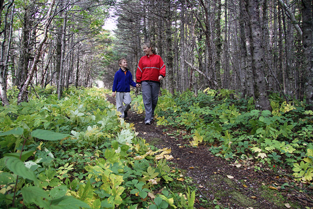
Distance: 2 km return
Time: 1 hour
Elevation gain: 5 m
In the shelter of forests and sand dunes, follow this remnant of the Old Mail Road between Shallow Bay campground and the day use area. At either end of the trail you can cross the dunes over boardwalk and return along the beach. This path was once part of the only overland route up the Northern Peninsula. Every winter from 1882 to 1952, mailmen travelled it by dogsled to deliver mail along the coast.
Trail notes:
- 3 km north of the community Cow Head.
- This trail starts at the Shallow Bay day-use area and follows the old winter mail road along the edge of the campground, and north to the Slants River.
- This is a shared-use trail ; Cyclists: Please ride in control and yield to other trail users.
#2 Steve's Trail
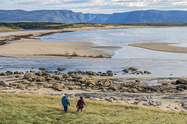
Distance: 1 km return
Time: 0.5 hour
Elevation gain: 41 m
Follow the trail to the mouth of Western Brook and a seaside meadow with panoramic views of the park’s northern coastline, Western Brook Gorge, and the Long Range Mountains. “Steve’s Trail” is a local name that recalls the fisherman who once used it to reach his fishing premises.
Trail notes:
- 34 km north of Rocky Harbour on Route 430.
- The trail starts beside the washroom facilities at the Broom Point parking lot and leads to the mouth of Western Brook through tuckamore forest.
- The gravel road leads to the restored summer fishing premises at Broom Point, and to a small cove, site of a cemetery from the 1800s.
#3 Western Brook Pond
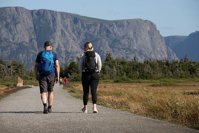
Distance: 6 km return (1.8 km scenic loop)
Time: 1-2 hours
Elevation gain: 42 m
Follow the trail to the shores of Western Brook Pond and its impressive backdrop of spectacular cliffs and the Long Range Mountains. Along the way you’ll cross the bogs and forested ridges of the parks’ coastal lowlands. Look for interpretive signs that explain some of the area’s natural features.
Trail notes:
- 27 km north of Rocky Harbour on Route 430.
- The 2.7 km gravel main trail leads to the departure point of the Western Brook Pond boat tour. Boat tours run daily from mid-May to mid-October, weather permitting.
- The view alone is worth the hike, even if you are not able to take the boat tour.
- You can also explore a 1.8-kilometre side loop to reach the banks of Western Brook. This path also leads to the start of the Snug Harbour route.
#4 Coastal Trail
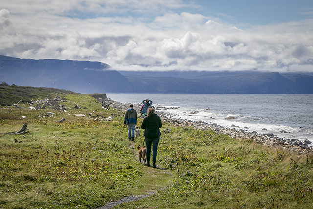
Distance: 6 km return
Time: 1-2 hours
Elevation gain: 33 m
The path once connected two small fishing communities: Bakers Brook and Green Point. It leads you by cobble beaches and through short but dense coastal forests known locally as “tuckamore.” It’s a perfect trail for enjoying coastal landscapes, ocean breezes, and views of the setting sun. Tuckamore is the Newfoundland word for the stunted trees that grow along the coast and in alpine areas. Frost and wind nip back the trees’ exposed branches, giving them their wind-swept profile.
Trail notes:
- Start this trail from Baker’s Brook parking lot, 10 km north of Rocky Harbour on Route 430.
- This trail follows the old winter mail road along the coast between Baker’s Brook and Green Point.
- The long cobble beach, small ponds, and coastal tuckamore provide a pleasant variety of habitats.
#5 Berry Head Pond Trail
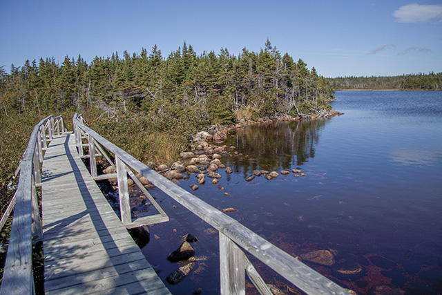
Distance: 2 km loop
Time: 0.5-1 hour
Elevation gain: 38 m
Follow this trail around Berry Head Pond and through forest and bogs. The patchwork of wetlands, ponds, and dense forests you’ll see is typical of the park’s coastal lowlands. This environment is a good place to look for songbirds and waterfowl.
Trail notes:
- 6 km north of Rocky Harbour on Route 430.
- The first 350 m of the trail is wheelchair accessible boardwalk, turning into a narrow path that circles the pond.
- Much of this trail is through forest, sheltered from the wind.
#6 Baker’s Brook Falls
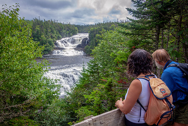
Distance: 10 km return
Time: 2-3 hours
Elevation gain: 195 m
The trail leads you through balsam fir forest to Bakers Brook Falls, a series of cascades over limestone ridges. The forest is in several stages of regeneration, recovering from the natural effects of winds and insects. Heavy moose browsing has limited its regrowth in many places.
Trail notes:
- Located in Berry Hill campground 5 km north of Rocky Harbour on Route 430.
- The falls are the main attraction of this trail, rivalled by a profusion of spring and summer wildflowers in the bog and forest.
- Much of this trail is through forest, sheltered from the wind, so be prepared for biting insects.
- At the riverside, follow the trail downstream to a viewpoint over a wide step-like waterfalls.
#7 Berry Hill Trail
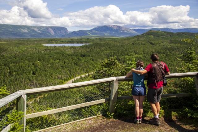
Distance: 1.5 km return
Time: 0.5-1 hour
Elevation gain: 92 m
Climb the short trail to several viewpoints atop Berry Hill, where you can enjoy spectacular vistas of the Long Range Mountains and the patchwork of forest, ponds, and bogs of our coastal lowlands.
Trail notes:
- Located in Berry Hill campground 5 km north of Rocky Harbour on Route 430.
- This trail is fine for an after-dinner stroll, or you can walk it before breakfast when the birds are in song.
- The climb is steep (stairs and rest benches are provided), but the view from the top is lovely.
- Please enjoy the views from behind the safety fences.
- Berry Hill is a low rock knob that was an island during higher sea-levels just after the last ice age. Rocks polished by waves 10,000 years ago are still visible on its flanks.
#8 Berry Hill Pond Trail
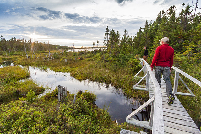
Distance: 2 km loop
Time: 0.5-1 hour
Elevation gain: 40 m
Follow the short loop to circle the forested shores of Berry Hill Pond. This area is a favourite beaver habitat, as lodges, dams, and stumps all indicate. Are beavers here this year? Look for fresh tree cuttings and the dug-up roots of water lilies, sure signs that beavers are present.
Trail notes:
- Located in Berry Hill campground.
- This trail is fine for an after-dinner stroll, or you can walk it before breakfast when the birds are in song.
#9 Gros Morne Mountain Trail
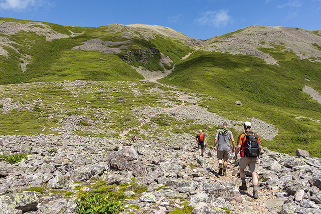
Distance: 17 km return
Time: 6-8.5 hours
Elevation gain: 1000 m
Follow the path to Gros Morne National Park’s highest point (806 m). Your efforts will be rewarded by breathtaking views of the Long Range Mountains and the Ten Mile Pond gorge. The flat summit is a harsh yet beautiful Arctic-alpine environment, home to arctic hare, rock ptarmigan, and arctic-alpine plants.
#9a Gros Morne Approach
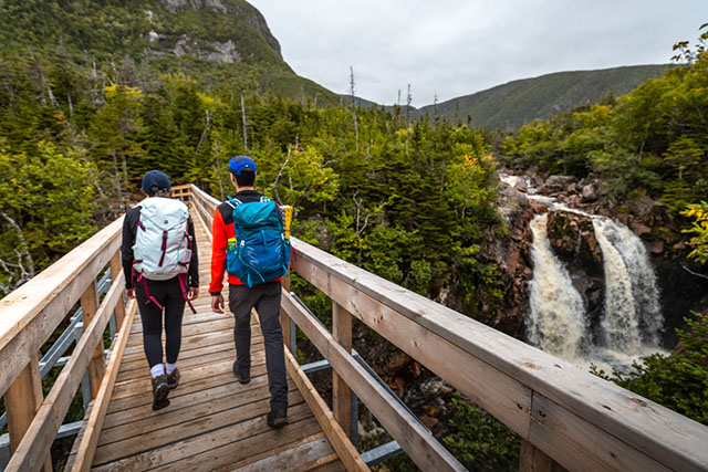
Distance: 9 km return
Time: 2.5-3.5 hours
Elevation gain: 463 m
The Approach Trail to the viewing platform at the base of Gros Morne Mountain winds through forest and follows Crow Gulch Brook. Along the way, enjoy spectacular views of waterfalls, Crow Cliff and Gros Morne Mountain. For a shorter hiking option, turn around at the bridge.
#9b Gros Morne Summit Trail
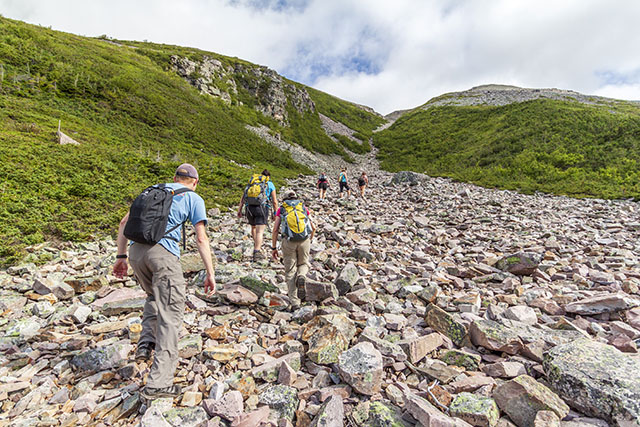
Distance: 8 km loop
Time: 3.5-5.5 hours
Elevation gain: 537 m
The more challenging mountain section of the trail starts at the viewing platform. It’s an 8-kilometre loop that takes you up almost 500 metres to the arctic-alpine plateau, then descends as a rough boulder-strewn path through Ferry Gulch. Give yourself 3.5 to 5.5 hours to hike this section of the trail.
Trail notes:
- The mountain (Summit Trail) is closed to hikers in May and June. At this time of year, soils are wet and easily eroded and animals are raising their young.
- Please stay on the trail, both for your safety and to reduce your effect on fragile environments.
- Dogs are strongly discouraged on the mountain—they cause stress for wildlife and the rocky terrain is hard on their paws.
- There is a primitive campsite at Ferry Gulch. Camping permit required. Please register with park staff.
- It is very important to be well-prepared before undertaking this hike.
- The view from the top is renowned, as is the exhausting climb up the gully.
- More information on the Gros Morne Mountain trail.
For your comfort and safety
- The mountaintop is sometimes in cloud. When it is, visibility is poor and it’s difficult to safely cross the mountain. Hiking in these conditions is not recommended.
- There is no food, shelter, or water available on the mountain. Be prepared for changes in weather as well as cooler and windier conditions on the mountain.
- Pack a windbreaker (preferably waterproof)
- Take at least 3 litres of water per person (5 on hot days).
- Sweater and trousers will usually be required at the top, even if it is warm and sunny below.
- Bring a lunch and snacks.
- Wear comfortable and sturdy footwear. Well broken-in hiking boots are recommended.
- Carry a First Aid Kit with treatment for blistered feet.
#10 Mattie Mitchell Trail
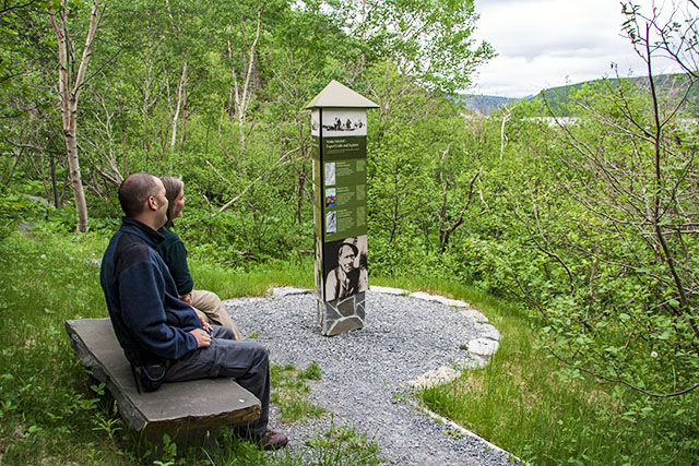
Distance: 250 m loop
Time: 0.25 hour
Elevation gain: 5 m
This short interpretive trail tells the story of Mattie Mitchell and the Mi’kmaq in Newfoundland. Mattie Mitchell was a renowned Mi’kmaw hunter, guide and prospector and has been recognized as a person of national historic significance. He made an exceptional contribution to the exploration and mapping of the Northern Peninsula of Newfoundland and to the development of the emerging Newfoundland economy of forestry and mining in the 20th century.
#11 Southeast Brook Falls Trail
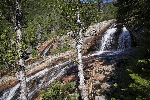
Distance: 700 m return
Time: 0.5 hour
Elevation gain: 32 m
Take a short stroll through a balsam fir and white birch forest to the top of Southeast Brook Falls. There the stream flows over a billion-year-old ridge of resistant granite and plunges 40 metres. The falls are particularly impressive during spring run-off. Signs along the trail guide you through a “Forest Bathing” experience.
Trail notes:
- Located 9 km north of the park entrance at Wiltondale, Route 430.
#12 Stuckless Pond Trail
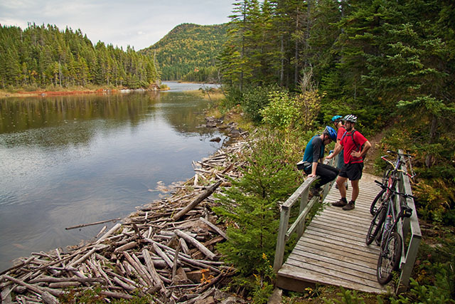
Distance: 9.5 km loop
Time: 2-3 hours
Elevation gain: 321 m
Follow the old logging road to skirt the shores of secluded Stuckless Pond. The trail crosses the Lomond River bridge, then climbs steadily and circles the sheltered pond. The surrounding forested valley is particularly beautiful decked out in early October’s fall colours.
Trail notes:
*BRIDGE OUT: Use of the trail is not recommended at this time due to the high water levels at the stream crossing. USE CAUTION.
- This is a shared-use trail.
- From the parking lot, a boardwalk crosses a peat bog.
- Mountain bikers:
- Suggested skill level: Intermediate
- Expect to encounter other trail users. Please ride in control and be ready to stop at anytime.
- Riding conditions range from hard-packed surface to rough rocky areas and narrow winding trails through forests.
- Located 16 km from Wiltondale, west on Route 431.
#13 Lomond River Trail
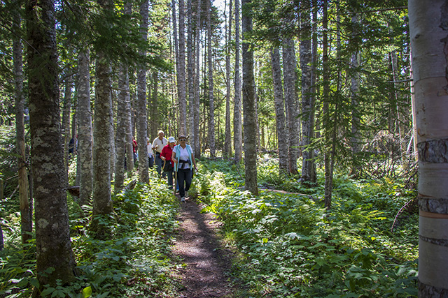
Distance: 8 km return
Time: 2-3 hours
Elevation gain: 230 m
Follow the trail as it traces its way through the sheltered valley of the Lomond River, where trees grow taller than anywhere else in the park. Beneath the mature forest canopy you’ll find aquiet peacefulness and views of the river and its forested slopes.
Trail notes:
- Located 16 km from Wiltondale, west on Route 431. Stuckless Pond Trail begins at the same location.
#14 Stanleyville Trail
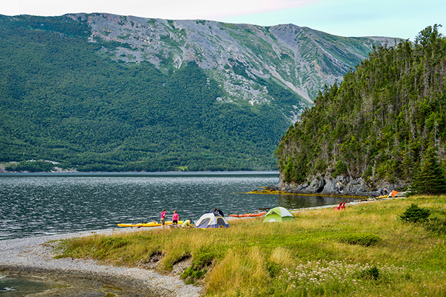
Distance: 4 km return
Time: 1-2 hours
Elevation gain: 220 m
Follow this historic path to the shores of Paynes Cove and the abandoned community of Stanleyville, which was a small logging town in the early 1900s. You can still find old machinery and garden plants today, though Stanleyville has been deserted for more than 80 years.
Trail notes:
- There is a primitive campsite at Stanleyville. Camping permit required. Please register with park staff.
- This trailhead starts at the day-use area playground in Lomond campground.
- The trail climbs over a ridge and down to a cove at Stanleyville.
- The trail follows the old road through a second-growth forest and past a present-day domestic cutting area.
#15 Lookout Trail
Distance: 5.8 km loop
Time: 2-3 hours
Elevation gain: 363 m
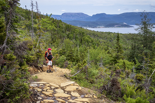
Follow the trail to one of the best panoramic vistas in the park. You’ll climb steadily through forest, then emerge from the trees onto a highland plateau. From the platform atop Partridgeberry Hill, you’ll enjoy spectacular views of Bonne Bay, Gros Morne Mountain, the Tablelands, and the Lookout Hills.
Trail notes:
- The trailhead starts in the Discovery Centre parking lot located in Woody Point on Route 431.
#16 Tablelands Trail
Distance: 4 km return
Time: 1-2 hours
Elevation gain: 88 m
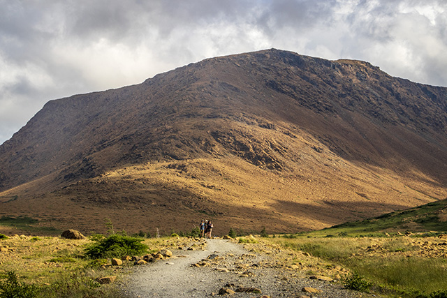
The main trail follows an old roadbed as it skirts the base of the mountain. You will see unusual plants and rocks as you enjoy broad panoramic views. The trail ends in the glacially carved Winter House Brook Canyon. For a shorter walk, branch off onto the Serpentine Loop, where you will see characteristic plants of the Tablelands alongside a winding path.
Trail notes:
- Guided interpretive hikes start from here during summer months. Check at a park facility for the schedule of events.
- The trailhead starts 4 km west of the Discovery Centre in Woody Point on Route 431.
- Geology here marks a time when the continents of Africa and North America collided, pushing these rocks, originally beneath the ocean, to their present position on land.
- Please stay on the trail as much as possible to avoid walking on the tiny rare plants that grow on this alien landscape.
#17 Green Gardens
Distance: 9 km return
Time: 3-4 hours
Elevation gain: 415 m
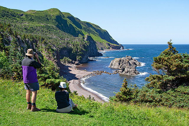
Follow the trail to a spectacular coastline of cliffs, sea stacks, and the meadows of Green Gardens. You’ll cross serpentine barrens, descend through forest, and reach the shore at Old Man Cove. Continue north along coastal headlands and meadows or take the stairs to a beach with waterfalls and a sea cave.
Trail notes:
- Getting to the coast and back is a half-day hike.
- The trail passes near cliff edges on the coastal headlands. Stay well back from the edge.
- There are primitive campsites at Old Man Cove. Camping permit required. Please register with park staff.
- More information on the Green Gardens trail.
#18 Trout River Pond Trail
Distance: 14 km return
Time: 4-5 hours
Elevation gain: 280 m
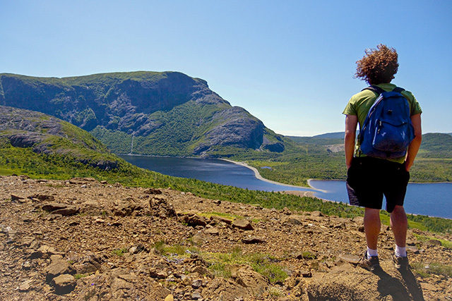
Follow the trail to reach a pristine part of the Tablelands. Your route skirts the north side of Trout River Pond through forests, and then opens onto the barren Tablelands. The landscape changes again at the "Narrows” between the inner and outer ponds—where you’ll enter a steep-sided valley.
Trail notes:
- The trail begins in the Trout River Pond day-use area.
- The first half is through shaded boreal forest, but then the vegetation dwindles to larch scrub and serpentine barrens. Arctic-alpine plants grow here, in the midst of patterned ground, erosion fans, and calcium springs.
- This trail provides magnificent views of the "Narrows" where two ponds meet, and of the glacial-carved valley of Trout River Inner Pond.
- Date modified :


