People in Waber falls
Waber falls
La Mauricie National Park
La Mauricie National Park features many inspiring places for visitors and Waber Falls is one of them. At 27 metres in height, the falls have a water flow that varies with the seasons, offering spectacular panoramas.
How to prepare
This one-day excursion combines paddling and hiking. So plan to leave early in the morning, bring your lunch and plenty of water.
It is recommended to enter the park through the Saint-Mathieu entrance. The starting point for this excursion is the Wapizagonke picnic area.
Before putting your boat in the water, be sure to wash, empty and dry it. Following these simple guidelines will help protect the lakes in La Mauricie National Park from invasive alien species.
You can also rent a boat at the boat rental kiosk. We suggest that you reserve in advance to avoid disappointment.
Level: intermediate
Time: 6 to 8 h
Details (going)

Distance: 4.6 km
Time: around 1:30

Distance: 4 km
Time: around 1:30
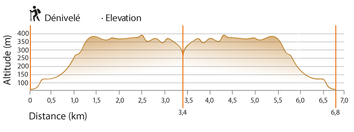
Elevation: 213 m
The return journey is the reverse of the outward journey.


Security

Even if swimming is possible, climbing and jumping into falls are prohiited and very dangerous. Be aware that it can take several hours to evacuate a victim. You are responsible for your own safety.

For assistance, a member of your group will have to turn back to notify an employee, or to go to the emergency telephone at the Wapizagonke Campground.

Cellular services do not cover this area of the park. Be sure that you always take all necessary measures to ensure your safety.
Related links
- Date modified :