Mast Trail
Rouge National Urban Park
![]()
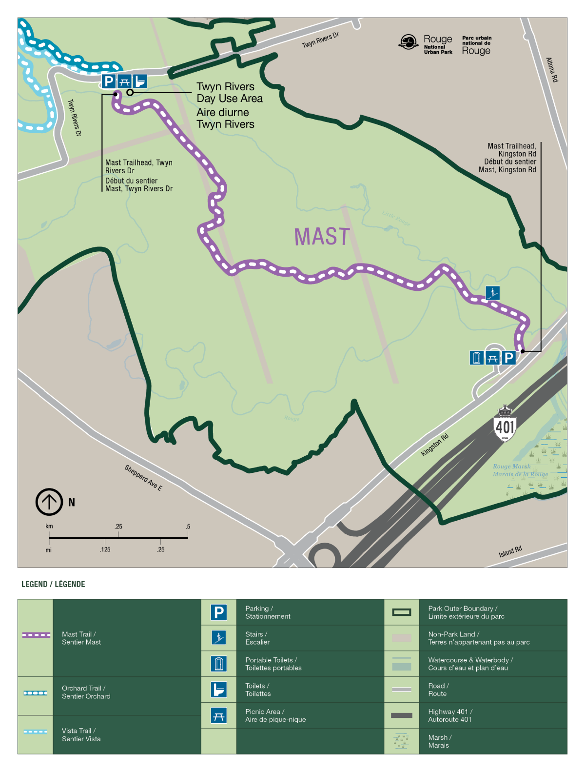
This classic Rouge Valley hike features excellent examples of rare Carolinian ecosystems while traversing a 200-year-old former logging route where pine trees were cut and floated down the river, eventually bound for ship building yards in Europe. The trail leads from the Glen Rouge Campground over the “hog’s back”, or ridge, north to Twyn Rivers Drive where it meets up with the Orchard and Vista trails. Parks Canada’s guided walks meet next to the Glen Rouge Campground parking lot at the trailhead.
| Location |
South trailhead North trailhead |
| Difficulty | Moderate to difficult, depending on experience, with some steep hills |
| Distance | 2.5 km (one way) |
| Time | 1 hour |
| Washrooms | Portable toilets are available seasonally |
| Parking | Free but extremely limited. The parking lot will be closed and locked at 9 pm daily for community safety and security. Lots will reopen between 7 am and 7:30 am daily. |
Trail Features
- Rare forests – The trail offers good examples of an interior forest and is home to rare Carolinian and Great Lakes-St. Lawrence ecosystems. Watch for the rare ovenbird.
- Cultural heritage – In the 1800s, European pioneers logged many of the area’s tall, straight white pines as a source of lumber for ship masts. Logs were floated down the river to Lake Ontario and eventually sent to ship building yards in Europe. An old ski hill from the 1950s was a hub of winter recreation, complete with a lift and chalet. Watch for the ‘hump’ the ski hill left behind in the middle of the hill.
- Cardio challenge – Get your heart pumping and grab a photo along the Mast Trail’s beautiful ridge walk and staircase.
Trail Map

- Date modified :