Reesor Way/Tanglewood Trail
Rouge National Urban Park
Please note: A section of the Reesor Way/Tanglewood Trail is closed until further notice. This closure is well marked on site and alternative trail options are available.
![]()
![]()
![]()
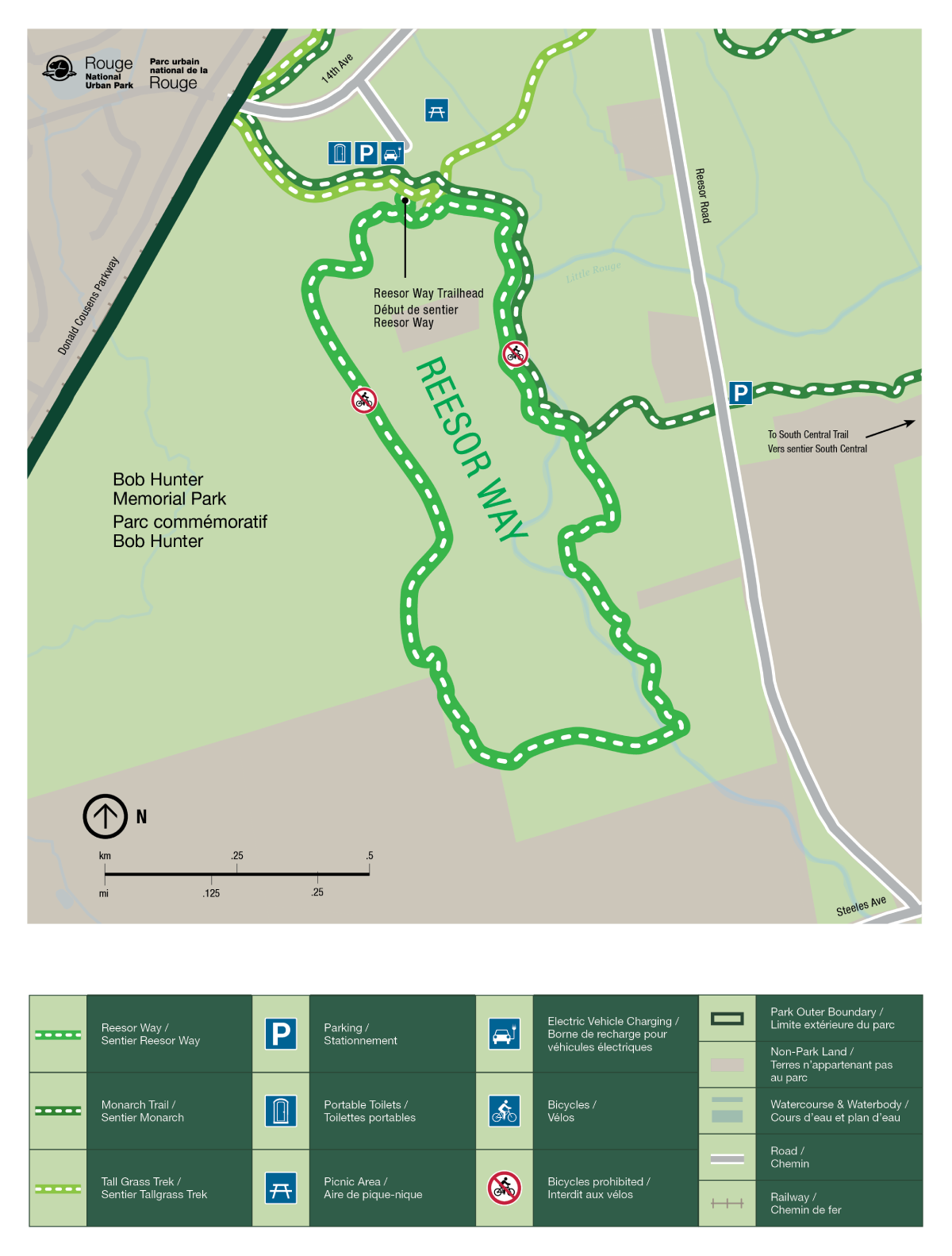
The Reesor Way trail provides two distinct experiences. The east section runs parallel to the Little Rouge River in a mix of established habitats, with excellent birding opportunities. The west section’s emerging forest and open sky recall the years of restoration that created Bob Hunter Memorial Park.
Explore microclimates first hand on the Tanglewood trail. Carved out from glacial activity, the Little Rouge River flood plain is in direct contrast to its spacious deciduous west slope and cedar dominated coniferous east slope.
| Location | 7277 14th Ave, Markham Lat: 43.860700, Long: -79.210934 Google Maps |
| Difficulty | Moderate |
| Distance | 3.3 km loop |
| Time | 1 to 1.5 hours |
| Washrooms | Seasonally available near the parking lot |
| Parking | Limited free parking is available all year at 7277 14th Avenue |
Accessibility information

Reesor Way
Surface: Natural surface and crushed limestone
Average width: 180 cm
Minimum width: 180 cm
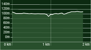
Average slope: 2.5%
Maximum slope: 13.9%
Average cross slope: 2.9%
Maximum cross slope: 8.7%

Tanglewood Trail
Surface: Natural surface and crushed limestone
Average width: 138 cm
Minimum width: 60 cm
Average slope: 3.9%
Maximum slope: 13.3%
Average cross slope: 5.1%
Maximum cross slope: 20.6%
Trail Map

- Date modified :