South Central Trail
Rouge National Urban Park
![]()
![]()
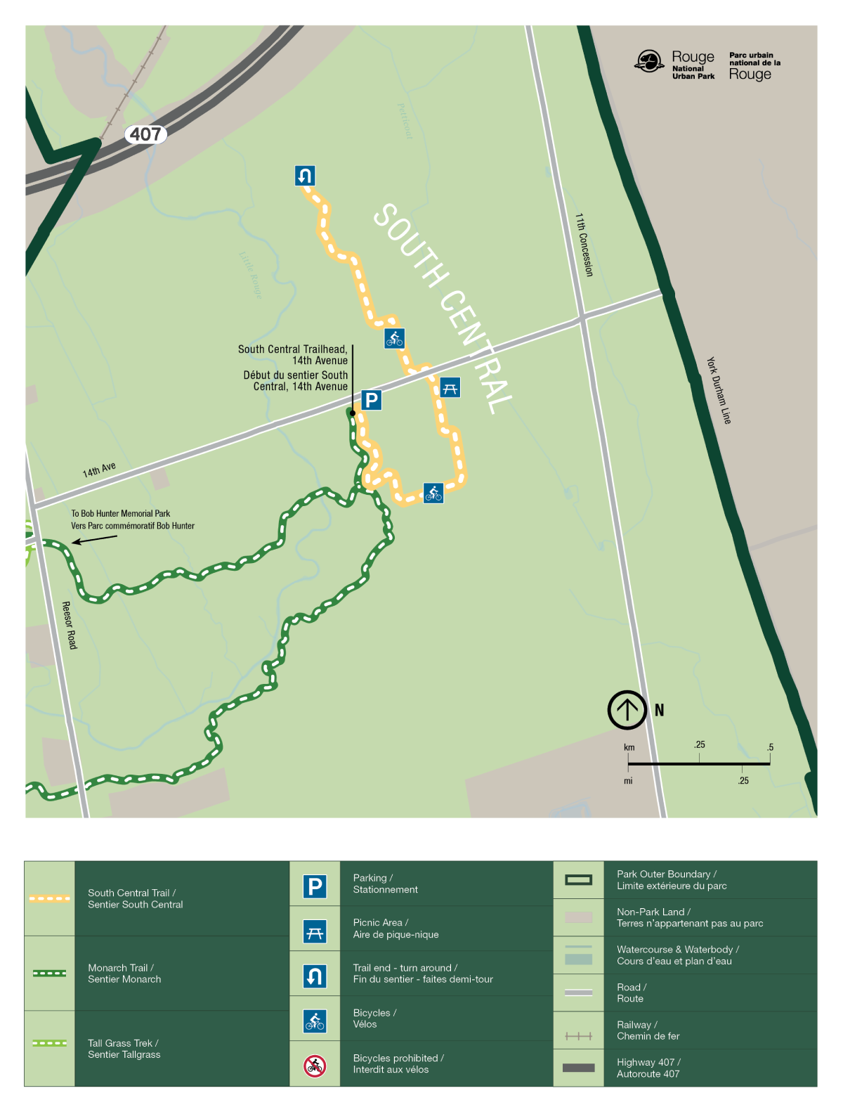
This section of trail starts in Cedar Grove, connects to Monarch trail in the West, and traverses hedgerows and a restoration area.
| Location |
Monarch Trailhead 14th Avenue
7933 14th Avenue, Markham
|
| Difficulty |
Easy Surface condition: compacted granular |
| Distance | 2.1 km (one way) |
| Time | 30 min |
| Washrooms | n/a |
| Parking | Limited free parking is available all year at Monarch Trailhead 14th Avenue |
Trail Features
- Seating nodes – Take a break and enjoy the view over the calming agricultural fields.
- Restored wetlands/forests – Walk through a forest/meadow habitat.
- Picnic area – Pack your lunch in a reusable container, as this trail has a picnic area just south of 14th Avenue protected by cedars.
Trail Map

- Date modified :