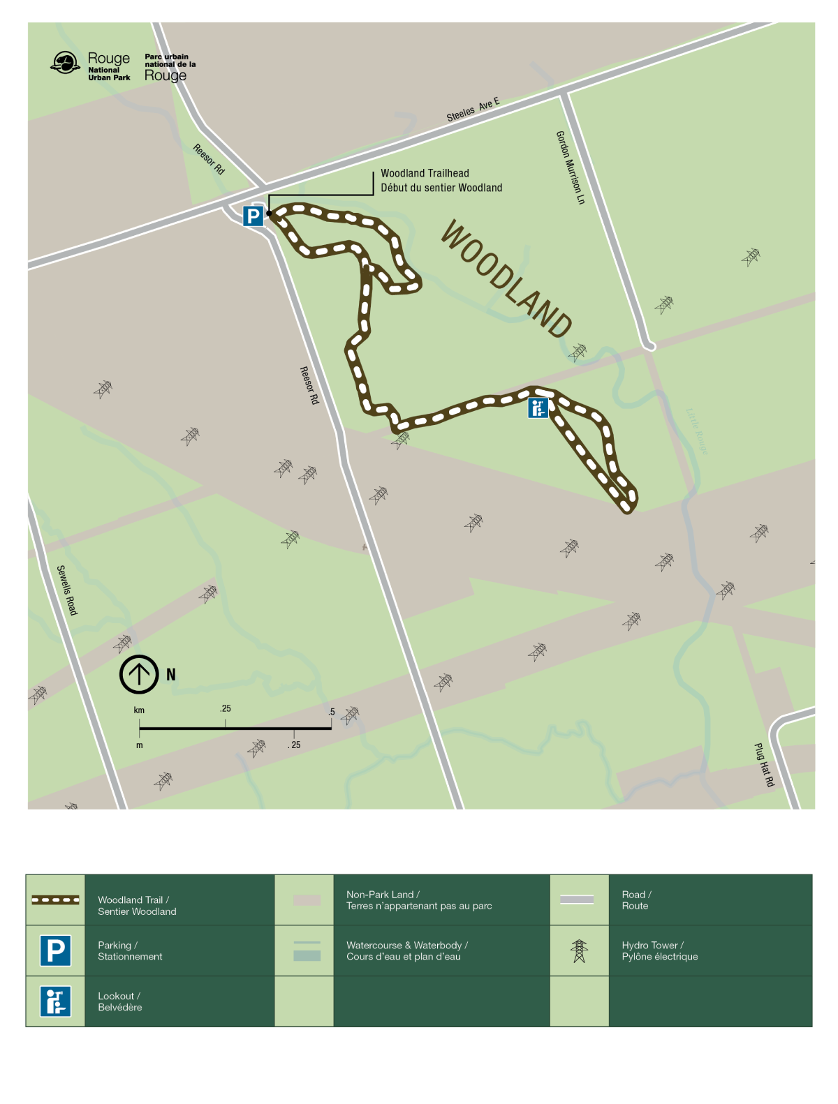
Woodland Trail
Rouge National Urban Park
![]()
The Woodland Trail provides shorter and longer walking options set against a backdrop of forests, meadows and water. Watch for signs of beaver activity, including gnawed trees, fallen branches and dams along the Little Rouge Creek. Parks Canada guided walks for the Woodland Trail meet in the main parking lot.
| Location | 19 Reesor Road, Toronto Lat: 43.848028, Long: -79.199444 Google Maps |
| Difficulty | Easy |
| Distance | 3.5 km loop |
| Time | 1.5 hours |
| Washrooms | None |
| Parking | Limited free parking is available all year at Woodland Day Use Area. |
Trail Features
- Busy beavers – The Woodland Trail is well known for signs and sightings of Canada’s national animal.
- River views – Follow the trail along the Rouge River. A mix of forest and meadow views offer a variety of plant and animal life.
- Cultural heritage – Look for remnants of an active and vibrant cottage and camping area, which was flooded by Hurricane Hazel in 1954.
Trail Map

- Date modified :