Valleyview Trail Network
Prince Albert National Park
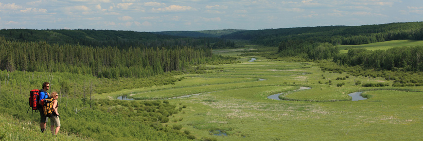
Enjoy the breathtaking, scenic views of the Sturgeon River Valley as you travel through mixed wood aspen forest, sedge meadows and fescue grasslands - all frequented by bison.
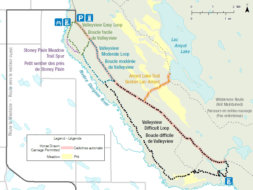
- Valleyview Lookout Trail
- Valleyview Easy Loop and Stoney Plain Meadow Spur
- Valleyview Moderate Loop
- Valleyview Difficult Loop
Length: 28.7 km Network
Time: 5 to 6 hours
Level of Difficulty:  Moderate, some steep sections.
Significant Features:The Valleyview Trail network is a series of three nested loop trails with adjoining trail spurs. It travels through rare rough fescue meadows and in areas frequented by the Sturgeon River plains bison herd.
Trailhead: Valleyview Day Use Area.
GPS Co-ordinates for Trailhead (in decimal degrees):
Lat.: 53.71045404 Long.: -106.71878295
Valleyview Lookout Trail
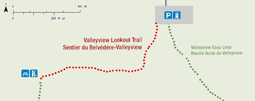
This short, wheelchair accessible, 200m trail takes you from the Valleyview Trailhead parking lot to a lookout point and picnic area.
Length: 200m one way
Time: 30 minutes
Level of Difficulty:  Easy
Easy
Significant Features: Scenic views of the Sturgeon River Valley and an accessible picnic site.
Valleyview Easy Loop and Stoney Plain Meadow Trail Spur
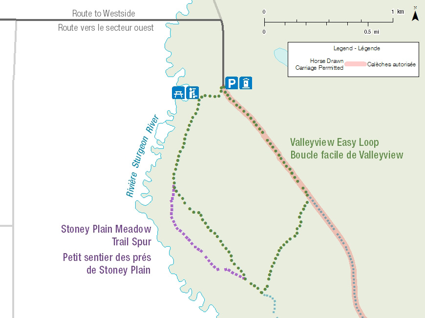
This loop is great for a family outing, as it offers a 200m accessible trail to the Valleyview picnic site. The Stoney Plain Meadow Trail Spur takes you down into the Sturgeon River Valley and through a meadow of rare rough fescue grass.
Length: 4.1km Loop
Time: 60 to 90 minutes
Level of Difficulty:  Easy
Easy
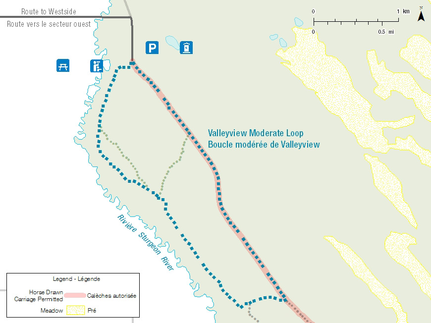
Valleyview Moderate Loop
This trail is linked to the Valleyview Easy Loop. Enjoy travelling through an aspen forest and along the Sturgeon River Valley. There are great random camping opportunities along the way.
Length: 8 km Loop
Time: 2 to 3 hours
Level of Difficulty:  Moderate, some steep sections.
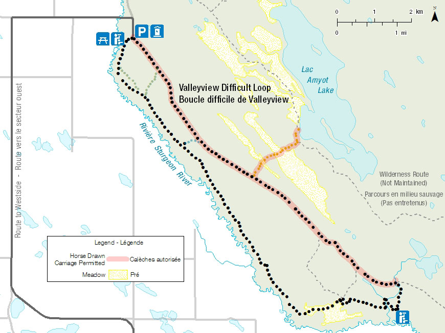
Valleyview Difficult Loop
This trail follows the entire length of the Valleyview Trail and has many great lookouts over the Sturgeon River Valley. This trail goes through Jonassons Flats, a rare fescue grassland. This trail also provides access to Sturgeon Lookout.
Length: 24.5 km Loop
Time: 8 to 10 hours
Level of Difficulty:  Difficult , some steep sections.
Related links
- Trail conditions
- Amyot Lake Trail
- Treebeard Trail
- Routes to Grey Owl's Cabin
- Fisher Trail
- Grey Owl Trail
- Hunters Trail
- Kingsmere River Trail
- Boundary Bog Trail
- Narrows Peninsula Trail
- Red Deer Trail
- Spruce River Highlands Trail
- Waskesiu River Trail
- Mud Creek Trail
- Shady Lake Trail
- Freight Tait Springs Trail
- Height-of-Land Lookout Tower
- Elk Trail
- Date modified :