
Long Island
Rideau Canal National Historic Site
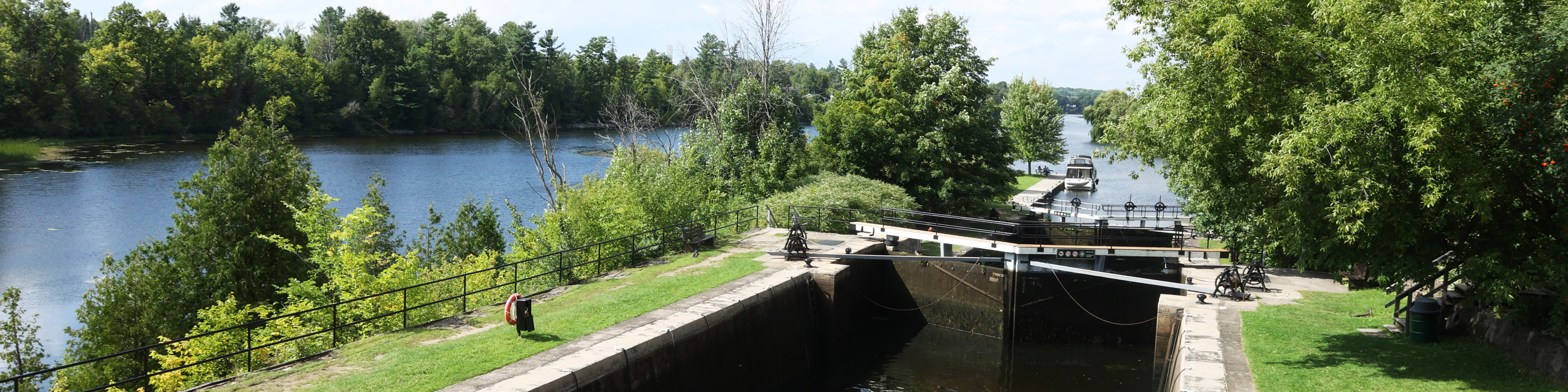
Just south of Ottawa, Long Island features a quiet location for overnight boaters, with considerable park space close by. Located next to Nicolls Island, features near these locks include a campground and the Long Island Stone Arch Dam.
How to get here
Long Island
390 Nicolls Island Road
Ottawa, Ontario
GPS: 45°15'02"N 75°42'07"W
Phone
613-692-3030
Email
rideau@pc.gc.ca
Navigational data
- Distance from Ottawa: 23.3 km (14.5 mi)
- Distance from Kingston: 178.8 km (111.1 mi)
- Nautical chart: #1512 (Sheet 2)
- Number of locks: 3 in flight
- Lock length: 40.8 m (134 ft)
- Lock width: 9.7 m (33 ft)
- Average lift: 7.6 m (24.9 ft)
Facilities and services
- Overnight mooring (2 nights max)
- Camping
- Washrooms
- Potable water
- Picnic tables
- Parking ($)
History
Close to 40km (25 miles) of waterway lies between Burritts Rapids to Long Island. Prior to canal construction, several rapids over a distance of about 3.9 km (2.4 mi), with a total drop of about 7.3 m (24 feet) made the west channel of Long Island impassable. A smaller set of rapids in the east channel could be run by canoe and it was this channel that was chosen to be the navigation way. Richmond, a community west of the river, was the only settlement in the area at this time. Several of the workers who had family with them built their own dwelling cabins during construction of the locks.
Read more history about this lockstationGoogle Street View
Related links
- Ottawa Locks
- Hartwells
- Hogs Back
- Black Rapids
- Burritts Rapids
- Lower Nicholsons
- Upper Nicholsons
- Clowes
- Merrickville
- Edmonds
- Old Slys
- Smiths Falls Combined
- Smiths Falls Detached
- Poonamalie
- Lower Beveridges
- Upper Beveridges
- Colonel By Island
- Narrows
- Newboro
- Chaffeys
- Davis
- Jones Falls
- Brass Point Bridge
- Upper Brewers
- Lower Brewers
- Kingston Mills
- Date modified :